
These engineers, who are in more fields than we thought; highways, parks, zoning works and even play a large role in determining the boundary of our house. In this article, we will look at what survey engineers do and what tools they use while working.
when you were littleWe have all seen brothers and sisters with strange cameras while we were playing ball in the street or around our school. Some of us may even have posed for these people. But what a tool cameranor the people at his head were cameramen.
It may have taken years for some of us, in fact. camera understand not. The name of these camera-like devices ”total station” is called. But besides that survey engineers There are many devices used. We will also talk about these devices, but first map engineering Let’s take a look at what it is:
What is survey engineering?
Various in our world measurements people who make plans and maps according to the results of these measurements. topographical engineer it’s called. Only measurements are not enough, a person who is a surveyor also needs to make many calculations.
What is drawn to our minds when we say survey engineer? your maps It is very normal to arrive, but the survey engineer has many duties. In the construction of many elements (roads, pavements, parks) and many other structures that we see around us when we go out, survey engineers It can be said that he made a great contribution.
So what do surveyors do?
- To take part in large-scale projects (highway, bridge, dam) soil measurement and similar works.
- They contribute to the formation of geographic information systems.
- Taking part in the land registry and cadastre and drawing regional maps.
- To take part in construction works.
- They plan and organize by examining the world and using technology.
It would be wrong to give only one answer to this question, because surveyors they actually exist in more areas than you might expect. We have listed some of these jobs above.
They take part in structures such as highways, bridges, dams.
In such structures order and stamina it really matters. Survey engineers do in ground measurements and ground availability. from math being used.
They also contribute to the formation of geographic information systems.
in our geography books Thanks to these engineers, we can access most of the information we see about the map. For example political mapsphysical maps, the scaling of these maps, shrinking and entering our classrooms is completely surveyors thanks to it.
Taking part in the land registry and cadastre and drawing regional maps.
The boundaries of our house and the land we own cartographer It can be drawn and documented by the survey engineers we call. Such drawings are more regional and individual regions belong. Again, from square meters to the borders of the building built on it. surveyors they are making this drawing.
To take part in construction works.
Two of the most important issues in the recent increase in zoning studies are earthquake resistance and, of course, order. In such structures survey engineers, They still play a big role in the zoning area.
They plan and organize by examining the world and using technology.
One geologist to examine the earth, although not as detailed survey engineers And the task of rendering our world on maps is really a big deal. maths wants. Survey engineers make these measurements and act according to the most accurate result.
We have said that survey engineers use many devices and tools, some of these devices are;
- GNSS/CORS
- Total Station
- Theodolite
- spirit level
- Plumb
Yes, survey engineersI use so many instruments in their measurements, as we said, this much in order to have no margin of error in their work. tool used in different conditions.
Let’s take a look at the most important of these tools;
total station
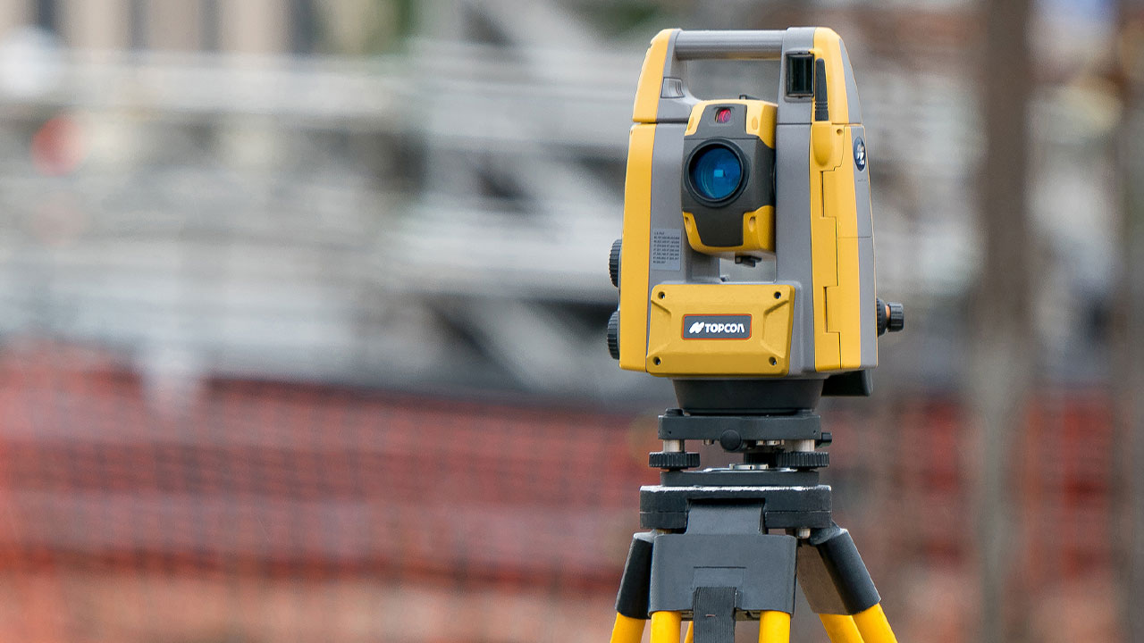
able to read distance topographic the name of the measuring device, total station it’s called. Yes, this measuring device, which is likened to a camera, is also the device we encounter most frequently on the roads and the only area where it is used. cartography not mining and building You can also use it in fields such as
GNSS/CORS
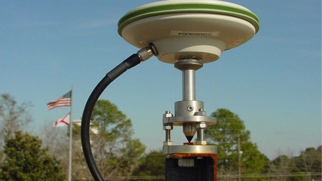
GNSS, in other words CORS If a team from the cadastre came to your house, you may have seen this device. real-time kinetic time RTK With the arrival of the so-called system to our country in the 90s, the location data from the satellite sensitivity used to increase.
Plumb

at first glance spinner Although it looks reminiscent, it has actually been used in the construction industry for years. It is a tool used to make vertical surfaces in a direction exactly perpendicular to the earth.
Spirit Level
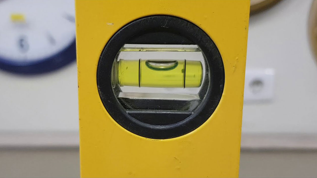
Although the spirit level has been used in the construction industry for years, its main purpose is slope This instrument, which is used to measure, is considered as a tool used by survey engineers. At the same time, it is a fact that it saves users from major mathematical operations.
Which section should be read to become a survey engineer?
To become a surveyor Geodesy and Photogrammetry It is necessary to complete a 4-year undergraduate education in one of the departments. geodesy; literally can be called geodesy, photogrammetry whereas; It can be briefly summarized as the name given to the measurement of two or three-dimensional objects through photographs.
The question everyone is wondering is how much is their salary?
If you have read the article so far, one of the subjects you are wondering about is salary. Most engineers in Turkey earn similar salaries as their groups. 2022 lowest salary of surveyor according to data 16.000 TL while the highest salary 42.000 TL known as. On average too 20.000 TL around can be given as an example.
These engineers, who are paid very well for Turkish standards, should not skip the tough 4-year education and it can be said that their jobs are really difficult.
What qualities should a surveyor have?
- basic engineering
- Tool information
- Field experience
- Knowledge of information systems
- advanced math
- Adapt to teamwork
survey engineersWe can say that the working areas and conditions are different for an ordinary engineer. More desk It is very important to have field experience as they work in the field rather than Many measurements and calculation they need tools because they have to do it, and of course they also need to know how to use them. map engineer one of his duties.
Most of the time surveyors works as a team. Two or more people take part in the field, so harmony between the team is very important.
In line with this information;
Even when we leave our home, we encounter many in the human element It can be said that these engineers with their fingers have made a great impact on our lives, albeit unnoticed. RoadsIt is known that surveyors have a finger in parks, sidewalks, zoning zones, highways, even our house and its borders.
On salary Considering the work they do and the difficulty of the training they receive, these engineers, who have a very good salary according to the current Turkish conditions, can say that they deserve this amount. You too surveyors You can tell your opinion about it in the comments, what do you think? wage Are they deserved for the work they do or is it more than they deserve?