
Are we facing enough of the realities we need to face before disasters occur? One of them is the Turkey Earthquake Hazard Map, which hangs on almost every school wall. Unfortunately, this map does not provide up-to-date information in terms of earthquake risk.
As we do after every earthquake disaster, we are talking about earthquake risks in different regions of Turkey. However, while doing this, we mostly remember not what the experts have said over the years, but the physical-visual counterparts. For example earthquake risk maps like.
We all know that Turkey has a tectonic structure with high earthquake risk. However, the crimson map, which is one of the first things we see while learning about it, apparently does not give enough accurate information about the fault lines. This view is in to the explanations of expert geoscientists is based.
The map we are talking about is the famous yellow-to-red map that has been hanging on the wall of almost every school for years:
Yes, this map gives information about the regions where the earthquake risk is concentrated in Turkey. It was last updated in 2018. However, this information does not contain accurate information about direct fault lines. Thanks to measurements made with new generation technologies, You can get more detailed results there are so many possibilities.
First, Geologist Prof. Dr. Let’s listen to Celal Şengör. Talking about the map above, he says, “I get nervous when I see this…”:
https://www.youtube.com/watch?v=nE_SAECQ3zk
Celal Şengör, who was a guest of Fox News, talked about the map projected on the screen from the 14th minute of the video above. “Now look, he has drawn the East Anatolian fault, and he has to draw the one that goes towards the South from that East Anatolian fault so that I can understand this earthquake.” she says and stands up and your red zones aren’t actually faults. “Supposedly the risk of earthquakes was drawn” states that there are fields.
There is no detailed risk map in Turkey, including that map above:
Professor at ITU Geological Engineering. Dr. Cenk Yaltırak; on the basis of points that will correspond to an area of 100 meters X 100 meters on the risk maps “spectral ground acceleration” indicates that it should be calculated. Spectral ground acceleration is a parameter that allows you to learn how much and how your living place will be affected by an earthquake, as Yaltırak states.
“This earthquake showed that those faults were not actually in the places drawn… The location of the fault lines may vary by 1-2 kilometers”
Yaltırak, who evaluated the earthquake in Kahramanmaraş as a guest on NTV; It has also confirmed the information that the maps that are the source of the risk maps and show the locations of the fault lines are not very reliable. According to Yaltırak due to agricultural activities and measurement errors The locations of the fault lines may vary by 1-2 kilometers.
Well, if the most known map about risk is not up-to-date, if we cannot get detailed information, how can we learn the earthquake risk in the place we live in correctly?
For this, it is possible to reach high-accuracy comments based on multiple maps and reports. If what you want to learn Instead of superficial information such as “The earthquake risk in Istanbul is very high” There are several detailed maps and reports published according to the cities that you can use if you want to reach the result up to the risk in the neighborhood or street you live in.
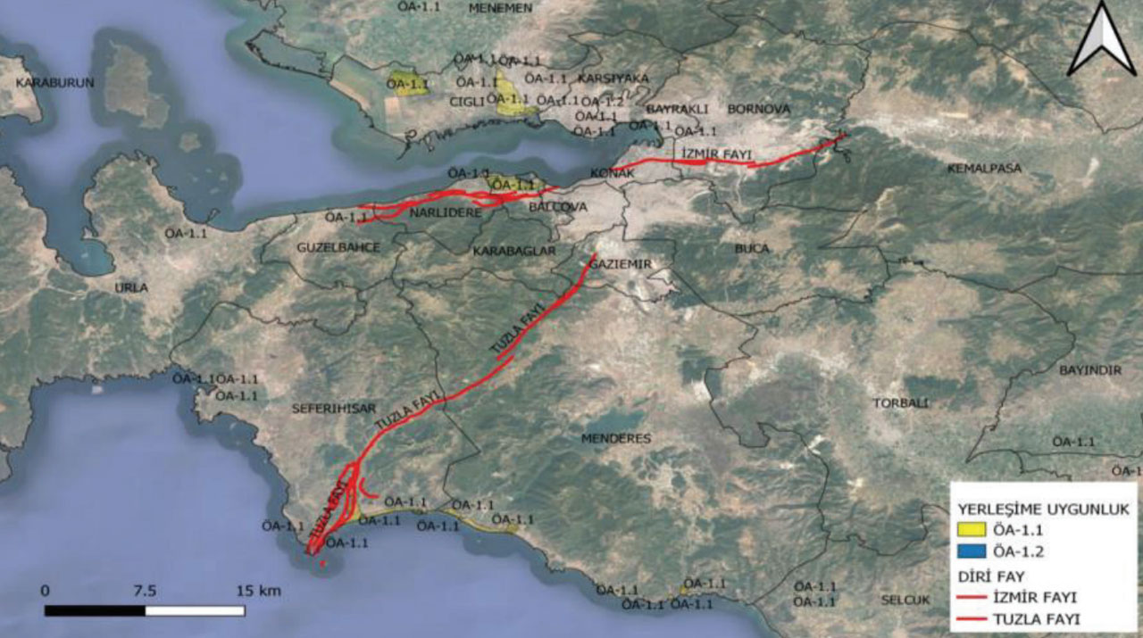
Step #1: Use the RENEWED LIVE Fault MAPs service published by MTA; because it shows the fault lines formed from 1900 to the present.
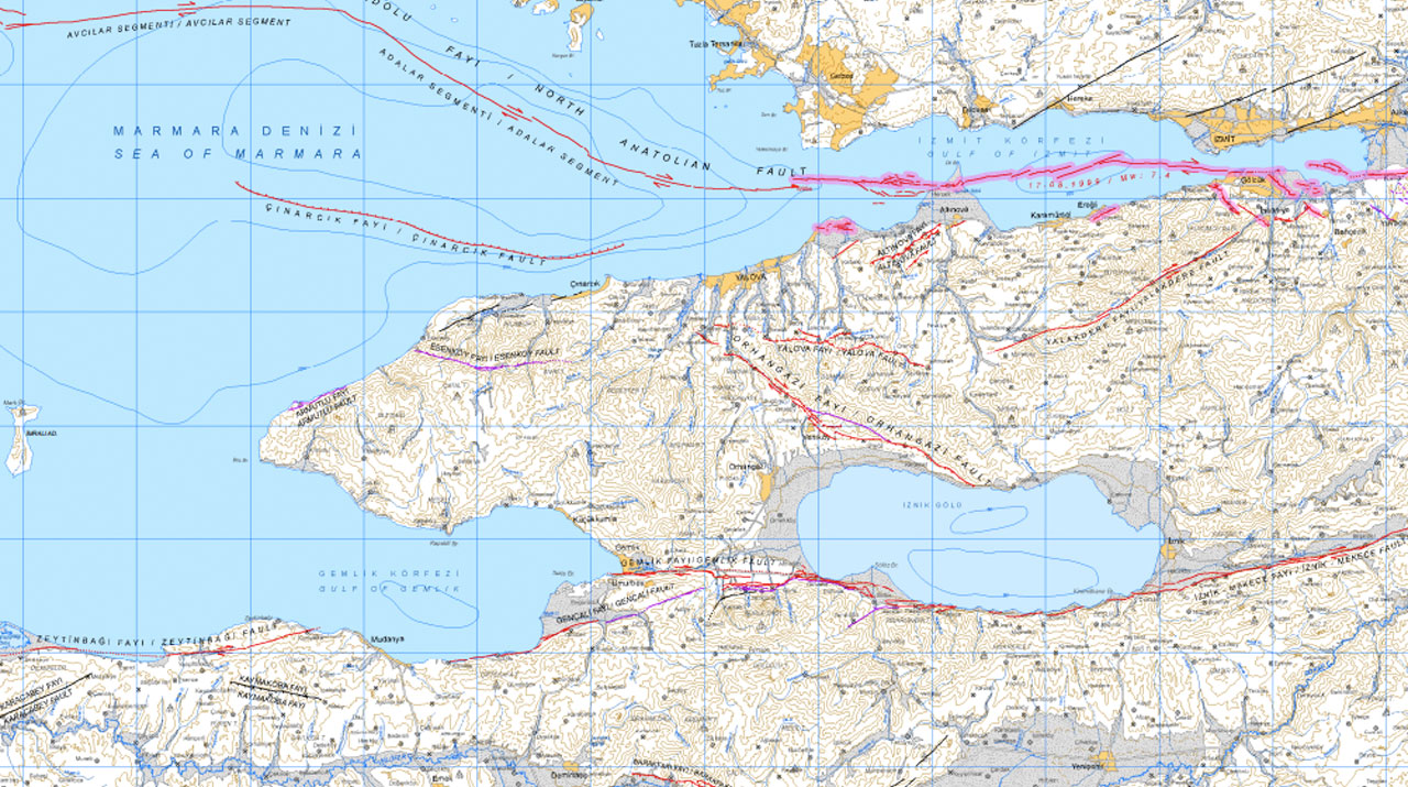
prepared with 1/250,000 scale and Celal Şengör is also a reference This map shows the locations of the fault lines and the areas they will affect in a very detailed and up-to-date manner. It was also updated after the Kahramanmaraş Earthquake. All you have to do is click on the box you are in on the map of Turkey and reach a more detailed map of the region you live in. On this PDF file, you can see the current situation by zooming in on the area you live in.
It doesn’t always work, but there is also an interactive map where you can see the above information:
This interactive map of fault lines builds on the basics from the map in Step #1, directly from where you live or even your home. whether the fault line passes under is showing. However, this information, we have stated that the earthquake risk of the place where you live is not enough. In fact, fault lines can be displayed at the locations of fault lines.
If you do not have any problems accessing the service after logging in, you can also access this interactive map from AFAD’s Turkey Earthquake Hazard Maps service on e-Government.
Step #2: Take a look at the detailed Provincial Disaster Risk Reduction Plans (IRAP) written for each province jointly by AFAD and governorships:
The most comprehensive report you can find in Turkey regarding the cities and regions you live in is the Disaster Risk Reduction Plans reports written by AFAD about all 81 provinces. Even so, and unfortunately, after the Great Southeast Earthquakes on February 6, what was written about Kahramanmaraş in this report was on the agenda again. In other words, everyone from the reporters to the academics was aware of it, only the society did not know much about it. Now we have no excuses to stop us from learning more about it being and where we live. You can find it here.
Step #3: You should definitely look at the ground maps of the city you live in, because the ground is often more important than the fault line.
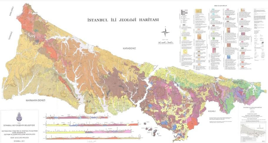
Soil maps are more effective than fault lines, according to most experts. Because it causes the earthquake to be felt more intensely and increases the effect of the destruction. For example, let’s talk according to a report published by METU after the 2020 Izmir Earthquake. The earthquake in Bayraklı, Manavkuyu region, where the destruction was the most in the earthquake, 3 to 5 times more severe than it should be was felt. The ground in the Manavkuyu region consists of alluvial soils that have been transported from other places over thousands of years.
RELATED NEWS
The Consequences of the Earthquake Could Have Been Different: Why Is It So Important to Build What Kinds of Buildings on Which Ground?
Step #4: Check out earthquake risk reports published by municipalities
Current earthquake risk reports published by Istanbul, Izmir and Ankara metropolitan municipalities give the estimated number of buildings to be demolished and the number of deaths in these cities by districts and neighborhoods. Although not on an interactive map, most reports provide you with detailed information about the regions you live in. just below To the reports published for 3 big cities You can contact your municipalities for other cities.
Step #5: Finally, if you have a high risk according to the steps above, have a damage assessment of the building you live in.
Damage assessment costs and potential costs of most homeowners in Turkey negative results It is known that they did not have damage assessment done because they could not afford it. However, considering the earthquake risk, you can save the life of yourself, your family and everyone in the building you live in by making this determination.
RELATED NEWS
What Steps Should We Follow to Find Out If Our Buildings Are Earthquake Resistant?
RELATED NEWS
Damage Inquiries of Houses in the Earthquake Zone Can Be Made Via e-Government
If you live in Istanbul, even if you are a tenant You can have your home’s earthquake risk checked. Moreover, as a result no mandatory sanctions:
- Step #1: First, we go to IMM’s Building Detection page,
- Step #2: We click on the application button and reach the form,
- Step #3: We enter our Personal Information,
- Step #4: We enter our Building Information,
- If we are a tenant, we indicate that we are a tenant here,
- Step #5: We read and approve the contract,
- If we own a property in the image upload area, our title deed,
- If we are a tenant, we upload an image of our rental agreement or one of our invoices.
- We upload our ID front and back photos.
- Step #6: Click the Save button to finish the process.
After the application stage, the building detection teams of IMM authorized by the ministry come to the address you provide; The columns and beams of the building, concrete quality, floor plan, external dimensions and irregularities are determined. The results are evaluated with an algorithm and the building “earthquake safety rate” being detected.
If a risk is detected, no sanctions are applied, we only get information. If the owners wish, the municipalities can initiate an administrative process for the building to be strengthened or renovated within the scope of urban transformation. Of course to the owners or tenants fee exemption, rental assistance support is also provided.