According to the data shared by AFAD, the acceleration of the earthquake that took place in the morning hours in Kahramanmaraş was measured as 664 gal. So what does this number mean?
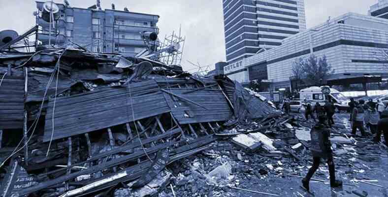
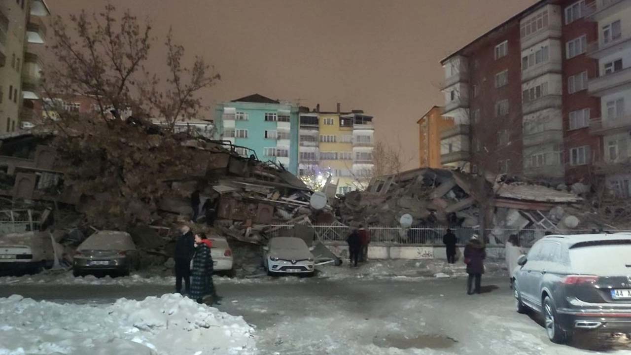
Gaziantep Şehitkamil, which took place at 04.17 in the morning on February 6, 7.7 magnitude earthquake, opened a great wound in Turkey. Buildings were destroyed in many provinces, it has already been announced that hundreds of citizens have lost their lives.
While the images from the earthquake area worried the whole of Turkey, the data shared about the earthquake revealed ‘how big’ this earthquake was. The acceleration of the earthquake was 3 times higher than the Gölcük earthquake on 17 August 1999.
Kahramanmaraş earthquake acceleration is 664 gal!
AFAD Earthquake Risk Reduction General Manager Prof. Dr. Orhan Tatar explained the acceleration of the earthquake as ‘664 gal‘ explained. This value was measured in the range of 250 – 300 gal in the 1999 Gölcük earthquake.
Turkish Earthquake Foundation Board Member Prof. Dr. According to Mustafa Erdik, earthquake, emerging in terms of energy It was an earthquake that was at least 4-5 times larger than the 1999 earthquake.
So, what does earthquake acceleration mean?
Earthquake acceleration shows how violently an earthquake shakes the earth. The acceleration representing gravity is 1 g (981 gal) While the magnitude of the earthquake shows the comparison of the shaking with gravity.
In this direction, the last earthquake, gravity 66% of the intensity It can be said that he shook the ground. earthquake acceleration, It may also not be related to the magnitude of the earthquake.. It can also be observed that smaller earthquakes have more acceleration.
Earthquake acceleration estimates in Turkey earthquake hazard map:
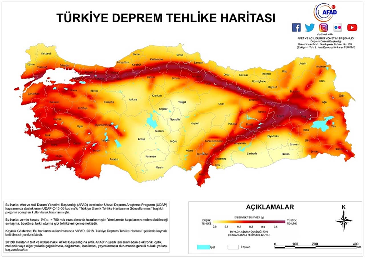
Turkey Earthquake Hazard Map of TMMOB Chamber of Geological Engineers includes earthquake acceleration forecasts for Turkey. 0.5 and above acceleration, ‘high danger‘ is displayed. Regions with high color intensity on the map represent the height of the estimated acceleration.
As can be seen on the map, it is seen that the earthquake acceleration is estimated to be 0.5 and above between Kahramanmaraş and Gaziantep, where the earthquake occurred. The same acceleration can be seen in the Sea of Marmara.