THE GOV website have issued 12 flood alerts for the UK today as Brits are set to be hit by wind blasts and snow this weekend.
The flood warnings are for: Earby Beck and Glusburn Beck; Exmoor Rivers; Lower Exe area; Lower River Soar in Leicestershire; Mid Bristol Avon area; Middle Exe area; Rivers Clyst and Culm and their tributaries; Rivers Duddon, Crake and Mill Beck; Severn Vyrnwy confluence; Somerset coast at Porlock Weir; Upper River Tamar and West Somerset Streams.
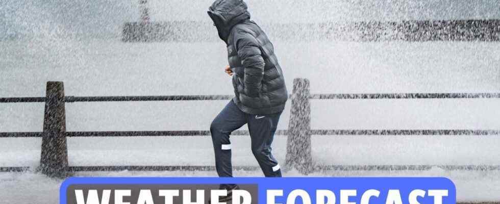
Brits are set to freeze this weekend with the mercury expected to drop at nighttime and snow falling in the north.
It comes after drivers were urged to stay alert on the roads on Friday with ice warnings covering half the country.
And the threat continues, particularly in Scotland, where there remains a high chance of ice patches throughout the country.
The Met Office said: “Early wintry showers in the north, and rain, sleet and hill snow further south will leave surfaces cold and wet by early evening.
“Clear spells for a time will allow ice to form in places, particularly for evening commuters, before temperatures trend up after midnight.
“The warning area highlights areas considered most likely to see ice.”
Read our weather live blog for the latest news and forecasts
-
Met Office: Cold and frosty start this morning
The Met Office tweeted: “Planning a #Sunday morning walk or just looking forward to a lie in?
“It will be a #cold and #frosty start to the day, but many of us will see some sunshine.
“Scattered heavy showers will affect some northern and western areas and these will drift east through the morning.”
-
Warnings over widespread ice
BBC forecaster Christopher Blanchett said: “Through the course of this evening and overnight, our concern is with ice and there is a Met Office yellow warning in force through west-central Scotland and the south.
“There is a chance of icy patches almost anywhere and under clear skies, temperatures are readily falling away to sub-zero and in rural parts of the northeast perhaps -6C.”
-
How to stay warm when outside
With the weather getting chillier and frostier, you’ll want to wrap up warm.
Here are some good tips for staying all snugly and cosy when outdoors:
- Prewarm your clothes.
- Invest in some quality thermals.
- Fleece leggings.
- Hand warmers.
- Cover every inch of skin.
- Eat fatty foods.
- Thermal flask.
- Keep moving.
- Keep hydrated.
- Keep your head covered.
- Tactical scarf-wearing – including keeping your nose and mouth covered
-
Snow to hit Britain this weekend
Brits are set to freeze this weekend with the mercury expected to drop at nighttime and snow falling in the north.
It comes after drivers were urged to stay alert on the roads on Friday with ice warnings covering half the country.
And the threat continues, particularly in Scotland, where there remains a high chance of ice patches throughout the country.
BBC forecaster Christopher Blanchett said: “Through the course of this evening and overnight, our concern is with ice and there is a Met Office yellow warning in force through west-central Scotland and the south.
“There is a chance of icy patches almost anywhere and under clear skies, temperatures are readily falling away to sub-zero and in rural parts of the northeast perhaps minus 6C.”
-
Weather forecast for the new week
Outbreaks of rain spreading east Monday, southeast staying dry.
Brightening from the northwest Tuesday and Wednesday, but overnight fog patches.
Cloud and blustery showers in the north.
-
This month will see drop in temperatures, says Met Office expert
Met Office forecaster Craig Snell said the average temperature in December and the beginning of January is usually around 7C or 8C, with the warmer weather due to a south-westerly wind making its way across the country.
The higher temperatures are usually localised, but “plenty of places” have seen highs of 15C over December.
However, he added that January could see a drop in temperatures because of an Arctic chill sweeping through from next week.
-
This week will be feeling colder for all
Met Office forecasters warned: “Cold northerly air dives south across the whole of the UK with brisk winds.
“It’s feeling colder for all, especially in the wind.”
In the capital, temperatures will plummet by 10C, from 16C at the weekend to just 6C today.
Meteorologist Simon Partridge said we’re facing a “shock to the system” as the chilly winds make it feel as cold as -2C.
“It will definitely be colder, so if you’re going out, think about an extra layer,” he said.
“You might need anything to keep the wind out because it’s not going to be pretty.”
-
How cold does it have to get in order to be sent home?
There isn’t a set temperature where employers have to send their employees home because it’s too cold.
And since October 2012, there’s no minimum temperatures in English schools, either.
The School Premises (England) Regulations 2012 don’t specify a safe classroom temperature, although the National Education Union advises a minimum of 18C.
In the workplace, it’s the employer’s responsibility to ensure that the workplace has additional heating if the temperatures do get too cold.
Employers are recommended to include flexible working hours or rotas to help reduce the effects of a cold snap – but they don’t have to.
Kate Palmer, head of advisory at employment law consultancy Peninsula, told The Sun an employer has no obligation to pay an employee if they fail to turn up for work because:
- The weather is bad
- Public transport is not running
- They miss hours because they turned up late
Plus, employees do not have a legal right to be paid in the event they take an emergency day off with their children.
-
When is it too cold to go to work? (Continued…)
Employers are not required to pay employees if they cannot get to work in bad weather, according to government rights.
You could be asked to work from home, but if this isn’t possible you may be asked to take unpaid or annual leave.
In the workplace, the mercury shouldn’t dip below 16C and employers should try to increase temperature in the office or workplace.
The Health and Safety Executive (HSE) states that a workplace should provide “reasonable comfort”.
Its Workplace Regulations 1999 state employers should “assess risks to health and safety and act where necessary (i.e. if the workplace temperature drops below the minimum guideline or if it is felt the temperature is too high)”.
-
When is it too cold to go to work?
Snow and ice have reappeared across Britain after a record mild spell to start the new year.
And though everyone loves a snow day, there’s unfortunately no guarantee of a day off school or work just because it’s snowing.
There is also no specific law around minimum or maximum working temperatures, although there are guidelines.
If it is safe and reasonable to travel to work, then you should do so.
But if it isn’t safe, contact your employer and check the company handbook.
Keep in mind that government guidance in all four UK nations currently advises you should work from home if it’s practical, too.
-
Coldest January on record in the UK
Leading bookmaker Coral has slashed the odds to 6-4 (from 3-1) for this month to end as the coldest January on record in the UK, as the latest forecasts point to falling temperatures from Wednesday.
The firm go 2-1 for this winter to be the coldest ever in the UK.
“We’ve enjoyed some unseasonable mild temperatures over the last few days but that is set to come to a crashing end later this week. With snow and freezing temperatures on their way, we have slashed the odds in half on this month ending as a record cold January,” said Coral’s John Hill.
-
22nd January to 5th February UK forecast
Conditions expected to remain broadly unsettled and changeable through this period with occasional spells of cold, wet and windy weather moving across from the Atlantic.
Western and northwestern parts likely to see the wettest and windiest conditions overall whilst eastern and southeastern parts probably seeing the most of any drier spells.
Temperatures likely to be slightly above average overall throughout, but there remains a possibility of short-lived colder spells.
Colder spells likely to bring a risk of snow at times, though mostly over high ground in the north.
Possibility that stronger systems will bring gales to western and northwestern areas throughout this period.
-
12th to 21st January
High pressure is expected across southern and central parts of the UK at the start of this period, bringing settled conditions and light winds, though it’s likely to be rather cloudy in some areas.
Temperatures will be generally around average, but there is a risk of some colder nights with local frost and fog.
Spells of rain, drizzle and stronger winds are likely further north, with temperatures near to or slightly above average here.
Confidence decreases through the period, but a return to generally more unsettled conditions across the UK is likely later on, with western and northwestern parts expected to continue to see the wettest and windiest weather.
Temperatures likely to remain around average.
-
Sunday to Tuesday outlook
Sunday dry and bright for many areas, although blustery showers in the northwest.
Cloud and rain reaching all areas through Monday, clearing southeast, and brightening from the northwest through Tuesday.
-
Drivers could be fined of £100 for wearing the wrong shoes when it snows
Thicker boots may keep your feet warm in the snow but they could get you into trouble and you with a heavy fine if you drive in them.
While wearing inappropriate shoes to drive isn’t technically illegal, careless driving due to unsuitable footwear can get you into trouble.
Rule 97 of the Highway Code states that before heading off on a drive, you must ensure that “clothing and footwear do not prevent you using the controls in a correct manner”.
If you are stopped by the police for careless driving and they decide your footwear caused the problem, you can face up to a £100 on-the-spot fine plus penalty points on your licence.
If you do need heavier boots for snow or cold weather conditions when you’re out and about, it’s best to take an additional, safer pair of shoes to drive in too.
-
Brits to see a new weather front from the Atlantic
Forecaster Greg Dewhurst said: “It’s quite a contrast compared to the record breaking New Year’s we’ve just seen.
“We’ve seen a big drop off in temperatures and it’s going to stay like that for most of the week.
“It’s well below the January average of 6C.
“We’re going to see wintry showers, mainly down the western edge of the country but we could also see some in the east.
“On Thursday a new weather front from the Atlantic will move eastwards bringing with it rain and hill snow.
“It’ll affect the north and west, parts of the Lake District and Wales, but we could also see some flurries further south.”
-
Make your car visible in poor winter weather
You can be fined up to £1,000 for failing to switch your car lights on when you’re driving.
Make sure they’re all working before you set out on your journey, and turn them on if you have to get out to clear snow.
If you use fog lights, remember to switch them off when visibility improves so they don’t dazzle other drivers or obscure your brake lights.
-
Manchester Sunday forecast
Further showers to start on Sunday, heavy at times.
These gradually fading and winds easing from the afternoon onwards, allowing it to feel slightly more pleasant later on.
Maximum temperature 7 °C.
-
BBC reporter is hit in the face with sudden snow drift
BBC reporter, Laura Trevelyan, was blasted by a snowstorm in Washington DC on January 6.
The British hack was filming for a piece on the anniversary of the Capitol riot – where Trump supporters stormed the Capitol building to stop the certification of the 2020 US presidential election.
Laura made it 20 seconds into the video before being lashed by a gust of white powder.
She covered her face, turned away from the icy interruption and exclaimed “oh God”.
-
Manchester’s evening forecast
Scattered showers feeding in overnight with some hill snow plus isolated hail and thunder.
Risk of icy stretches forming as temperatures fall close to freezing, with a patchy grass frost developing as well.
Feeling cold in the ongoing brisk winds. Minimum temperature 0 °C.
-
Rain clearing
Rain clearing in the Southern and Eastern counties of England.
-
13th to 22nd of January outlook
A continuation of largely settled conditions is most likely as we head into the middle of January with high pressure in charge across the south of the country.
Most areas will be dry with any spells of rain and stronger winds likely to be restricted to northern parts of the country.
The settled weather will bring widespread overnight frost as well as morning fog patches.
Amounts of sunshine are uncertain with areas of fog and low cloud potentially lingering by day in places, especially in the south.
How long the predominantly settled condition persist is uncertain with an increasing chance of some unsettled spells returning to many parts as we head towards the end of the period.
-
How is this evening shaping up?
Rain soon clearing the southeast, but persisting across Shetland.
Clear spells but also blustery showers, mainly in the west, heavy in places with possible hail, and wintry over some hills.
Windy, especially in the southwest. Cold, odd icy patches possible.
-
Cardiff evening forecast
Scattered showers feeding in overnight with some hill snow plus isolated hail and thunder.
Risk of icy stretches forming as temperatures fall close to freezing.
Feeling cold in the ongoing brisk winds, with near gales in the far south west. Minimum temperature 0 °C.
-
Rainy start to Sunday for most
Early showers in the west gradually becoming mostly confined to parts of northern England by late afternoon.
Otherwise sunny spells and mostly dry in the south and east. Wind easing.