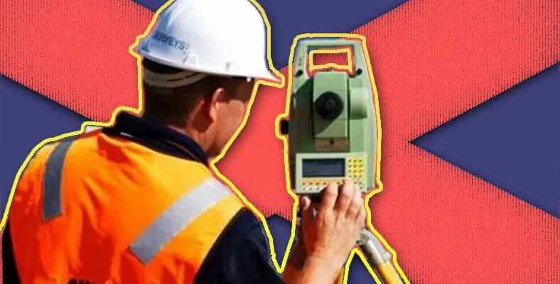
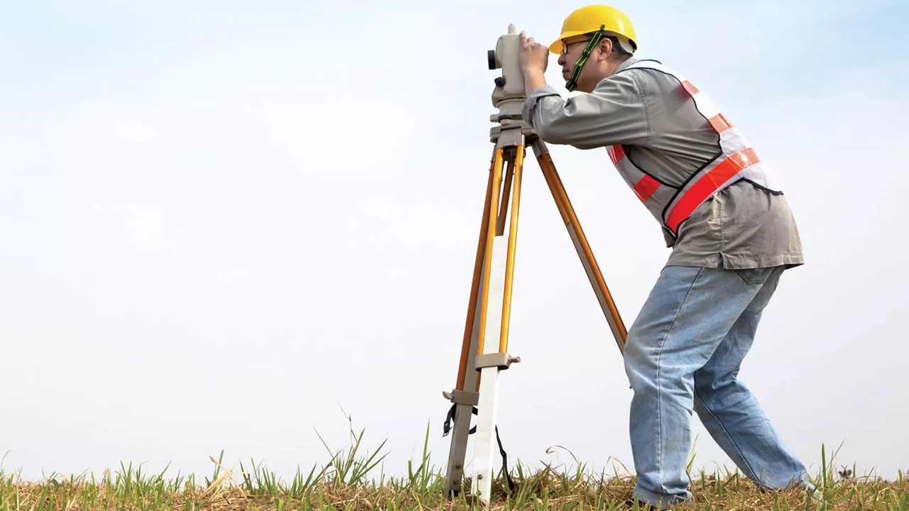
This instrument, which we wanted to pose when we saw it for the first time as a child, is actually used by engineers or surveyors to make measurements about the terrain.
survey engineers “level” It makes various measurements in the field with this device called. The device also “theodolite”, “total station” There are also other versions like these, but since mentioning the differences between them will drown the subject in too many technical details, we will explain these tools that serve the same purpose in a simple language as possible.
Usually used in cartography, but It is also common in the construction industry. Apart from these, it can be used for positioning and determining the dimensions of large transportation vehicles such as ships, trains and planes.
These devices find the elevation difference between two determined locations in the field.
By measuring heights on a flat land by making topographic horizontal measurement Allows mapping. Indicates how much height difference there is between specified locations. If the installation is not done well, if it is not well placed on the ground, there will be slippage in the elevations, as incorrect measurements will be made.
There are different types of levels such as optical, laser and digital.
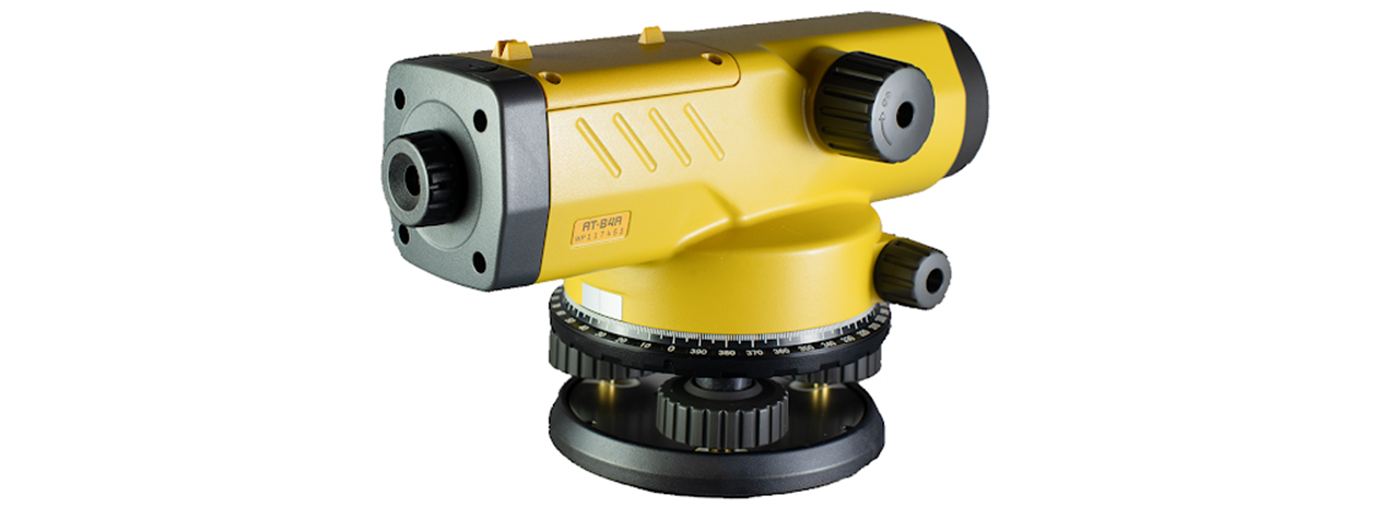
Optics can turn left or right, but not up or down. The laser ones can be rotated by turning the head. laser scans aroundcan move horizontally and vertically. Digitals, on the other hand, measure downwards, find the elevation difference between two points and map out the height difference.
You will probably never use it, but let’s briefly explain how it is used:
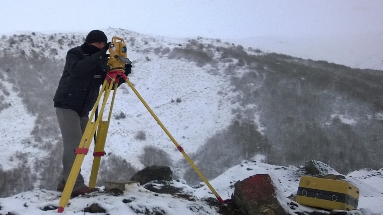
The bubble level is centered and adjusted vertically using the adjusting wheels. Then the feet are fixed with leveling screws. From the three lines in the lens the long one in the middle must be read.
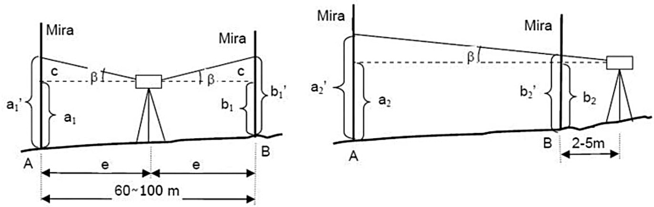
A piece with a meter look of “mira” It should be placed in a vertical position to the floor by means of a bubble level. The bubble is moving upwards. After a reading is made with the binocular part (level) at the first position, the reading is made for the second position where the tower is located, and the elevation difference is calculated by taking the value difference between these two points.
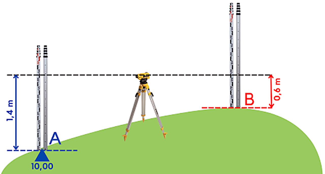
With a clearer explanation; Let the elevation of point A be 10.00 meters, and the level should read the staff as 1.40 meters. Thus, the level of the level becomes 11.40 meters. If Nivo reads the mirage at point B as 0.60 meters, then the elevation of B is 10.80 meters. We hope it is understood.
They can make incorrect measurements from time to time.
Therefore, they need to be checked frequently. new types of tools Problems can be fixed with software. The prices of these tools vary between 1,500 TL and 12,000 TL.
Sources: TMMOB Chamber of Mechanical Engineers, Construction Account
RELATED NEWS