Perhaps the biggest detail that catches our eye while examining the world map is that the borders of the states on the African continent are as smooth as if they were drawn with a ruler. But is this really the case?
As a result of both the wars that took place centuries ago and the continental movements that have been going on for millions of years. borders on the world map many times changed. Sometimes with the birth or collapse of an empire, the world map is redrawn; A detail that has not changed for years, inevitably arouses curiosity in people who do not know the story.
Come together now borders of states in the African continent Let’s take a look at why it is smoother than states on other continents, and whether there is a similar event in other continents.
The story of Africa, which we still refer to as a colonial region today, is much older than we thought.
- African continent and regions dominated by colonial states
As we all know, almost every state in the African continent, due to its rich underground resources. It was exploited by imperialist states for years. According to many sources, the exploitation activities in Africa were first initiated in 576 BC by Egyptian Pharaoh II. It was started by Amasis and this process was followed by Greek colonialism and Alexander the Great.
The more advanced colonial phase was in the 13th century, around 1215. With the Portuguese invasion of the Moroccan coast started and ignited the first fuse of the colony that would continue for years.
It would be appropriate to say that after Portugal, “the imperialist who broke his rope came to Africa”.
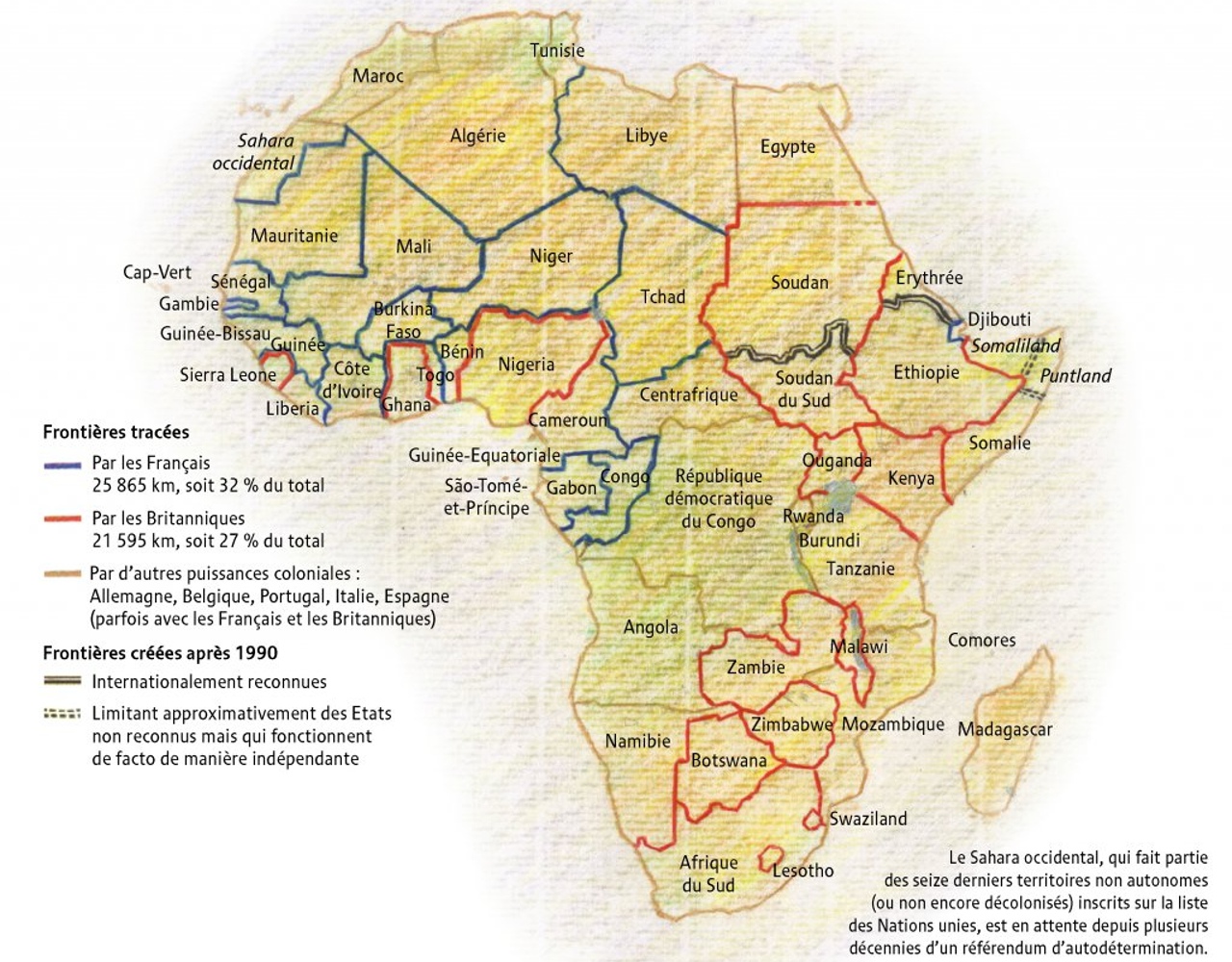
- The blues represent France, the reds the United Kingdom, and the brown lines denote the route of other colonial states.
After the Portuguese invasion of the coast in 1215 mainly the UK and France including; European states such as Belgium, Spain and Italy began to exploit the manpower and underground wealth in the African continent.
By the end of the 19th century, both in terms of land size and population second largest continent in the world There is no region (except Ethiopia) that has not been occupied by the imperialists in Africa, which has 24.4% of the world’s land. However, in 1876 the occupation rate was 10% across the continent. This rate rose to 90% in 1890, just 14 years later.
When the cake on the table was big and valuable, the European states wanted to compromise and prevent the cake from falling apart!
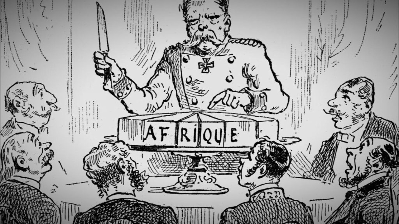
Africa, let alone potential and existing workforce, in terms of underground riches. It was perhaps the richest continent in the world. and the imperialist states wanted to get the biggest share they could get without fighting with each other. In this direction, the King of Belgium II. At the invitation of Leopold, a conference was held in Berlin, Germany.
As a result of the Berlin Conference The African continent has 52 different regions. Left. The primary and most important issue that was taken into consideration while making regional distinctions was the underground resources. In this direction, borders were drawn to the African continent by taking into account the lines of latitude and longitude.
Between these 52 regions (each a state on paper), the United Kingdom (20), France (18), Portugal (5), Spain (4), Italy (3) and Belgium (2) according to the importance of power and territory shared. In addition, as a result of this conference, the state that occupied the region that had its share was obliged to have soldiers there. In the absence of soldiers, other states would be deemed to be allowed to claim the demilitarized zone.
The decisions taken that day have a very high share in the basis of the ongoing African problems.

The negative effects of the European states drawing borders with rulers according to their own interests at the Berlin Conference still continue even today. With these arbitrary boundary divisions same tribe divided into 3 different states or two tribes that are hostile and completely opposite to each other were given to the same state.
Due to this problem brought by the border separation with the ruler, it is constantly being used in African countries. border warfare, civil war, political instability and popular uprising negative situations occur. This naturally causes problems such as financial, basic needs, education and industry that Africa is experiencing today.
Although Europeans seem to have withdrawn from Africa today, it is difficult to talk about the positive situation in Africa.
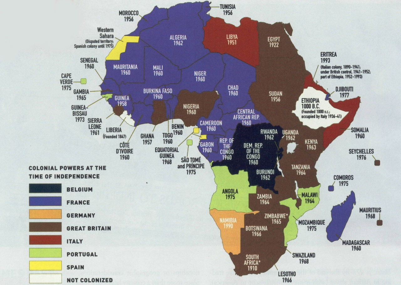
years of independence
Although European states today state that they have withdrawn their soldiers from Africa and put an end to the colony, both the steps they have taken in the past and the for the problems they inherited It is not possible to say that the general situation of Africa is good.
50% of its population is under the age of 19 Composed of young people and 54 different states, the African continent might have been one of the most developed regions in the world, with its young population and underground riches, had it not been a completely exploited continent in the past.
If you look closely at the Americas after the world map, it is possible to see Africa there.
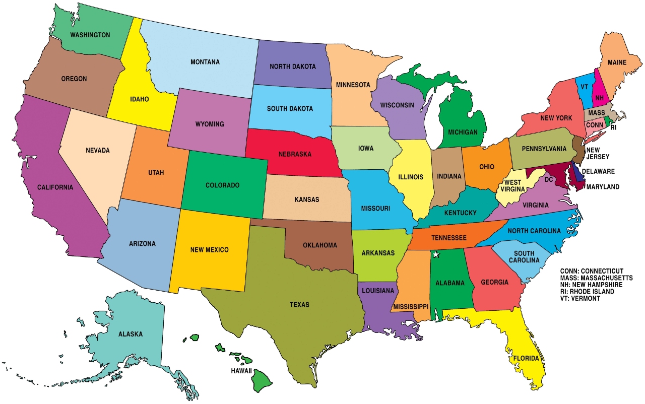
After explaining in details and reasons why the borders of African states are smooth, just like Africa, it experienced a period of colonialism and had no different fate in terms of borders. to the United States we wouldn’t have mentioned it. Although we refer to different administrative units in America as states, we also refer to these states as states. “state” statement is also true. In fact, the name of the United States of America comes from the 50 states (states) in it today.
When you examine closely, the borders of the states in the USA, which was once a British colony, are as smooth as drawn with a ruler, as in Africa, because these borders are also borders drawn on the desk. When drawing the borders of states in the USA latitude and longitude lines, desert, highway, waterways and rivers drawn with attention to factors such as
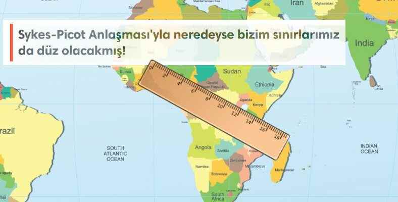
If everything had continued as the European states wanted, the borders of our country would have been drawn by rulers today.
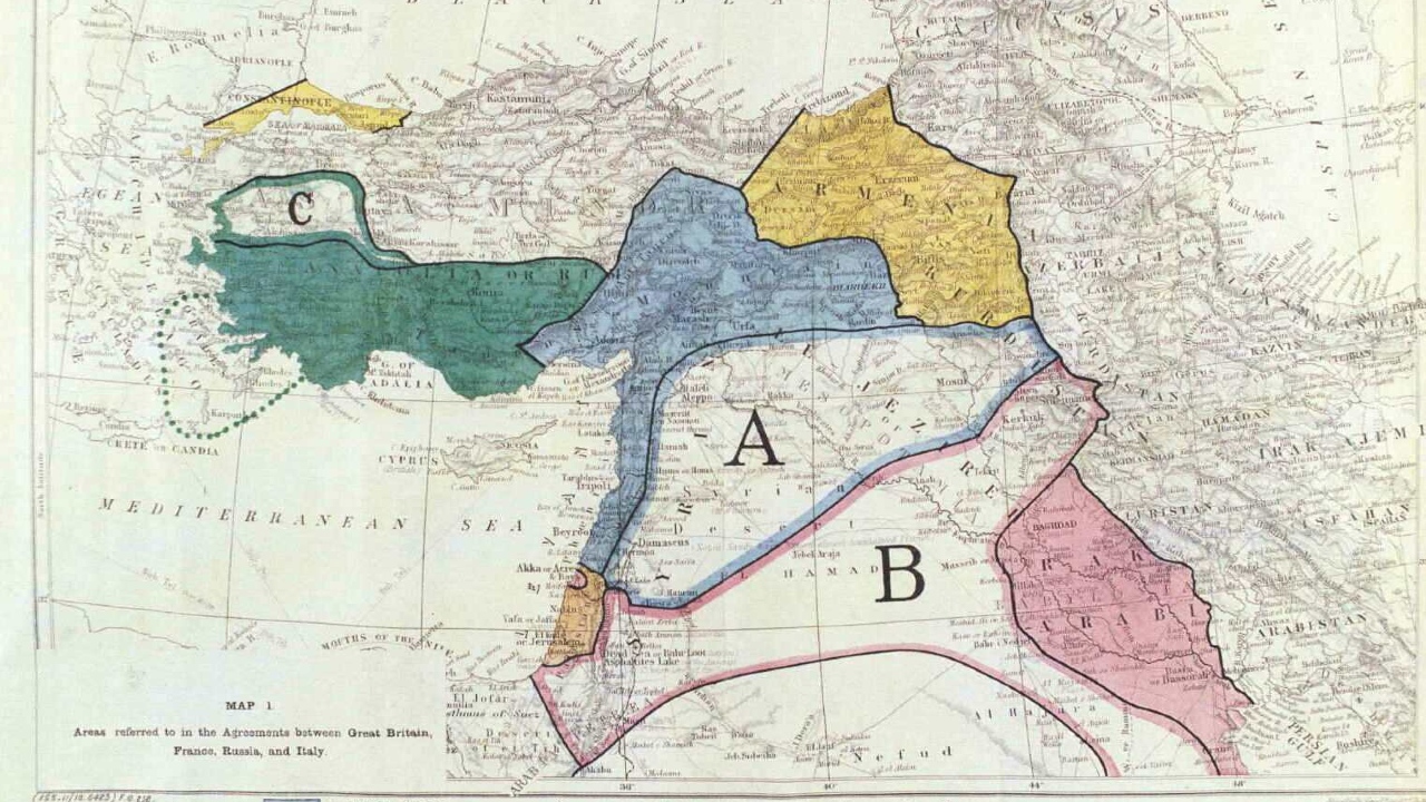
While the First World War was going on, the European states had taken a preliminary step in the division of land by making many secret agreements among themselves. One of these collusion Sykes-Picot Agreement He also divided the borders of the eastern and southern parts of our country as if they were drawn with a ruler.
This secret agreement, signed between the United Kingdom and France and approved by Russia, was later disclosed by Russia, just like other secret agreements. The borders in the Sykes-Picot Agreement are clearer than in Sèvres, but the maps in both agreements are now rag We can easily say that they are.
Boundaries at the table, not with a ruler drawn with a bayonet fight on the ground We wish to combine the rightful pride of being a state with education and science and transfer it to future generations properly…
Resources: 1 / 2 / 3 / 4 /
RELATED NEWS