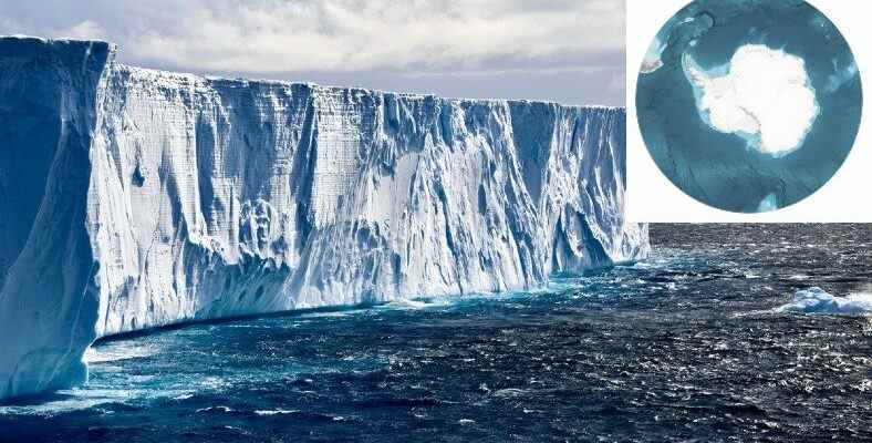
The most detailed map of the Southern Ocean floor, which surrounds Antarctica and holds the title of the world’s fifth ocean, has been produced. Experts stated that this map could be useful for issues such as climate changes.
The body of water surrounding Antarctica is considered by many experts to be the Antarctic Ocean or Southern Ocean is referred to as. Last year, we shared with you that this ocean will be added to the maps and our planet will now have five oceans.
Now, a very important development has been made regarding the Southern Ocean. With the help of data collected over the years, scientists have discovered the bottom of this great body of water. most detailed map announced their release and shared many high-resolution images with us.
It can work on issues such as climate change and saving living things.
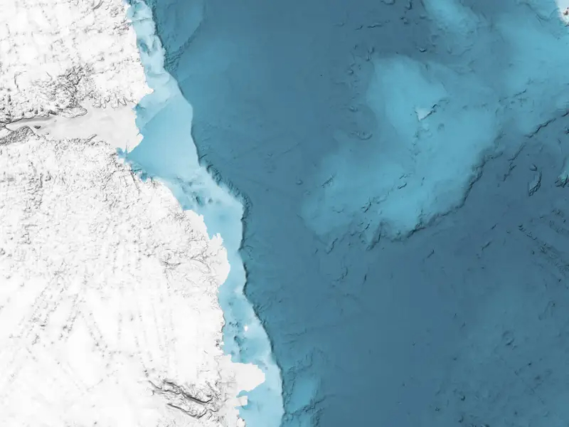
It was reported that the mapping, which was shared on Scientific Data last Tuesday and revealed images of the depths of the water, was created with the help of data obtained from sonar devices collected for years. It was also stated that the map is part of a project that plans to map all the ocean floors by 2030. About the ocean floors so far 21% of It was also included in the explanations that it was mapped.
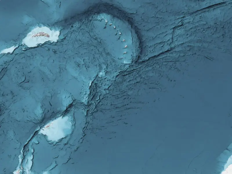
According to the statements, the map, which is stated to have unprecedented details, covers an area of 48 million kilometers and for the first time Factorian Deep It allows us to take a look at the details of a pit with a depth of 7,432 meters, called Boris Dorschel, one of the authors of the study, also says in his statements that the map provides the most accurate information about the water floor and that is why it is very important.
of this map climate change It has been announced that it can also be used for issues that threaten the future of our planet, such as . The reason for this is the important role the oceans have in increasing the world’s temperature. Such maps could be used to improve climate change models by providing information about how the world’s oceans are moving, experts say.
In addition, maps of ocean floors are of great importance for biodiversity. in the protection of marine life may also be used. It was noted that this would be achieved by determining the place where living things live and thus protecting their natural habitats.
RELATED NEWS
‘City-size’ Ice Piece Collapses in Antarctica: “An Indicator of What Could Happen in the Future” [Video]
Source :
https://www.businessinsider.com/antarctica-hi-res-images-show-ocean-floor-in-greatest-ever-detail-2022-6