NASA shared the damage map of 7.7 and 7.6 earthquakes in Kahramanmaraş.
US Aeronautics and Space Administration (NASA)shared the report of the damage caused by the 7.7 and 7.5 earthquakes in Kahramanmaraş. Report, Kahramanmaraş, its district Türkoğlu and Gaziantep Nurdağı shows the damage on the map.
Geophysicist Eric Fielding, who made a statement from NASA Jet Propulsion Laboratory, said that earthquakes very big and strong He stated that it caused a great shock in many cities and districts. Fielding reported that they compared the first earthquake in Kahramanmaraş to the earthquake that destroyed the city of San Francisco in 1906.
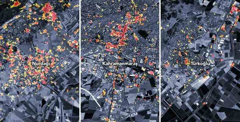
Damage map shared by NASA
The shared map includes parts of Kahramanmaraş, Türkoğlu district and Gaziantep Nurdağı. Dark red dots on buildings and infrastructures heavy damage and reveals possible changes in the image of the area. On the other hand orange and yellow parts shows moderately and partially damaged areas. It is stated that each point corresponds to an area of approximately 30 meters.
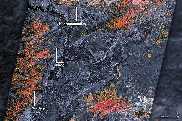
NASA released the map on February 8, 2023. ALOS-2 He stated that it was created through data collected by PALSAR-2 on its satellite. The scientists compared the data from February 8 with observations they made earlier (April 7, 2021 and April 6, 2022) and detected changes and identified damaged areas.
In addition, NASA administrator Shanna McClain stated that they are closely monitoring the event and will try to map the damage via satellites as much as possible. While it is reported that updates will be made as new data comes out, intervention efforts are supported. monitor for landslide risks, power outages, and weather that may pose a challenge It was reported that they will use satellites for this purpose.
RELATED NEWS
‘Before and After’ Satellite Images Showing How the Fault Moved in the Kahramanmaraş Earthquake
Source :
https://earthobservatory.nasa.gov/images/150949/earthquake-damage-in-turkiye