
There are many different types of maps that we use to examine the world we live in, the continents and our country from a bird’s eye view. Political maps have the simplest details among them. They are plain because they only show boundaries and some essential features. Let’s take a closer look at the countries and cities on the high-resolution World and Turkey political map.
Let’s go back a bit and remember the geography lesson in high school. The teacher would hang a map on the board or open a map on new smart boards. If this is a political map, we only have country and city names. Turkey and World political map, It’s pretty plain compared to other types of maps because it only shows continents, countries, cities, borders, and some important water resources with simple lines and colors.
In fact, even from the name of the political map, it turns out what kind of picture it draws. Because while a physical map shows that our world is too unique to be divided by borders, a political map reveals people’s constant curiosity to confine countries within certain borders. I mean, political issues. High resolution Over the political map of the world and Turkey Let’s take a closer look at countries and cities.
Let’s start with the basics: What is a political map?
political map; of the world, continents, countries, cities, or such a particular region It is a type of map that shows the borders. Political maps only show the official boundaries of settlements such as country, city, county. If there are, important water resources such as oceans, seas, rivers and lakes in the region also take their place on the political map.
Details shown on political maps vary depending on where the map is pointing. Examining the world political map you only come across country borders and huge water resources. It is possible to encounter city details and smaller water resources on the political map of Turkey, and even villages and small rivers on the district maps.
What does a political map do?
The main purpose of the political map is to measure across borders. According to the scale of the map in question There is a proportion line in the lower right or left corner. According to the scale, this ratio clearly reveals the distance between the borders. As we often see in the news, political maps appear when there is a border debate in matters between countries.
Political maps can change over time. Great states may disintegrate, some small countries may gain independence, countries may unite or certain regions may change hands. So if you’re going to use a political map for important research, make sure you have the most up-to-date version. Of course, if the purpose is entertainment, who will hire you?
What do the colors on the political map indicate?
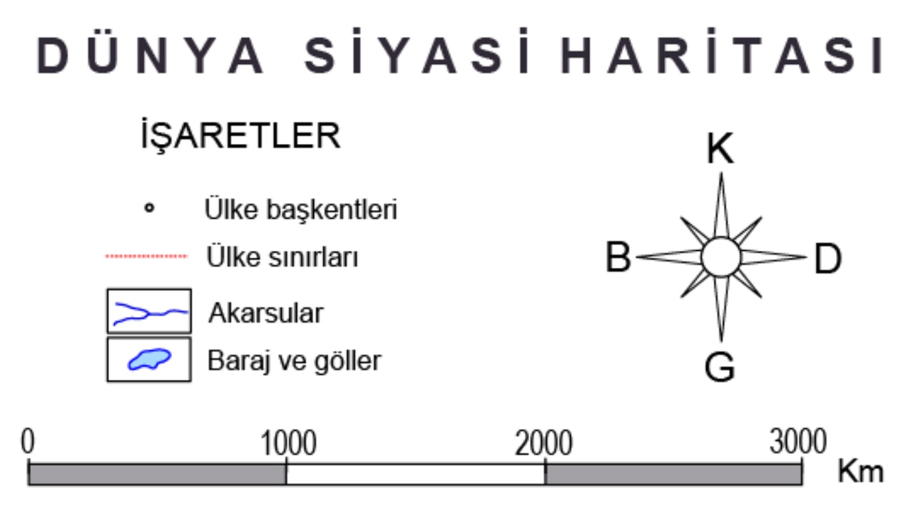
In fact, the colors on political maps do not mean much. In other words, the continent, country, city and county colors you see on the map; may vary at the discretion of the issuing institution. Signs are important on political maps. Some of the signs you can see on political maps are as follows;
- The dot indicates country capitals.
- The hollow dot mark indicates city centers.
- Dashed red lines indicate country borders.
- Black lines indicate city limits.
- Lakes, streams and similar water resources are indicated with signs appropriate to the geographical shape such as blue lines and blue dots.
It will appear on world, continent, Turkey, city and similar political maps. signs generally have these meanings. Of course, different signs can be added according to the region shown by the political map. The meaning of the signs on the map is explained with a table in the lower right or left corner.
High resolution World political map:
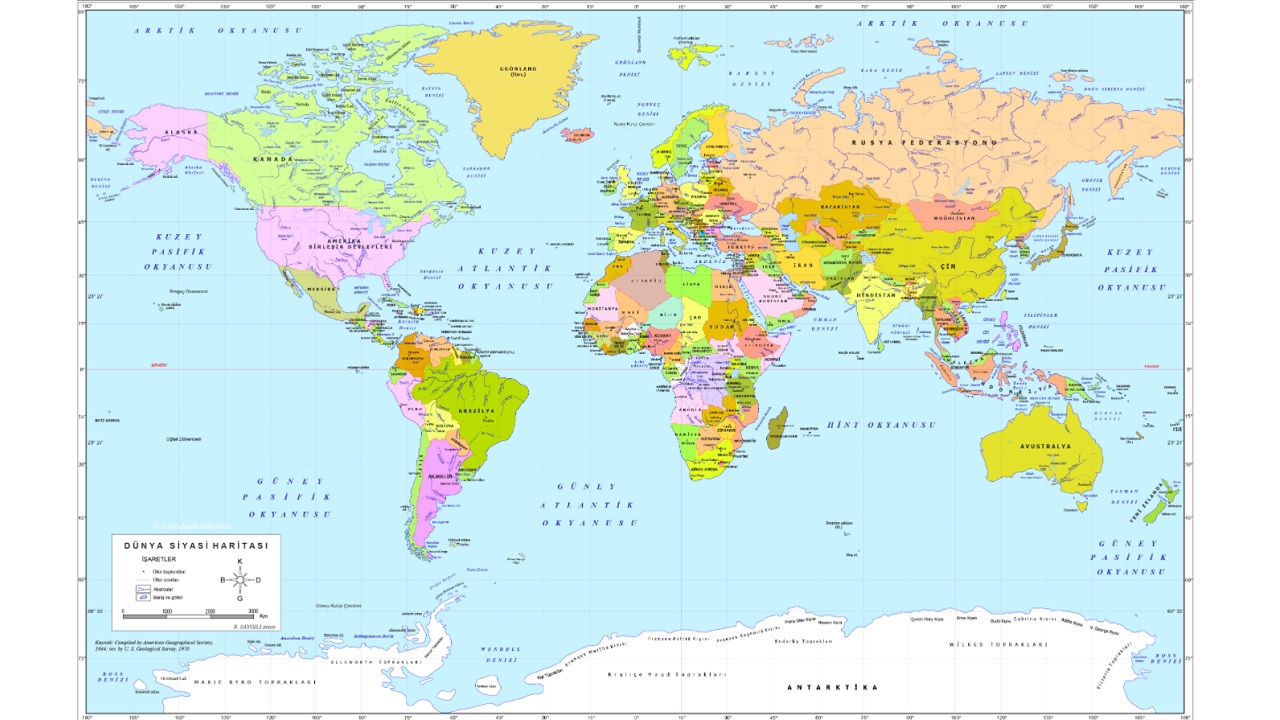
This is how the whole world we live in looks like on a political map. You can access the high resolution version of the world political map via the link here.
High resolution political map of Turkey:
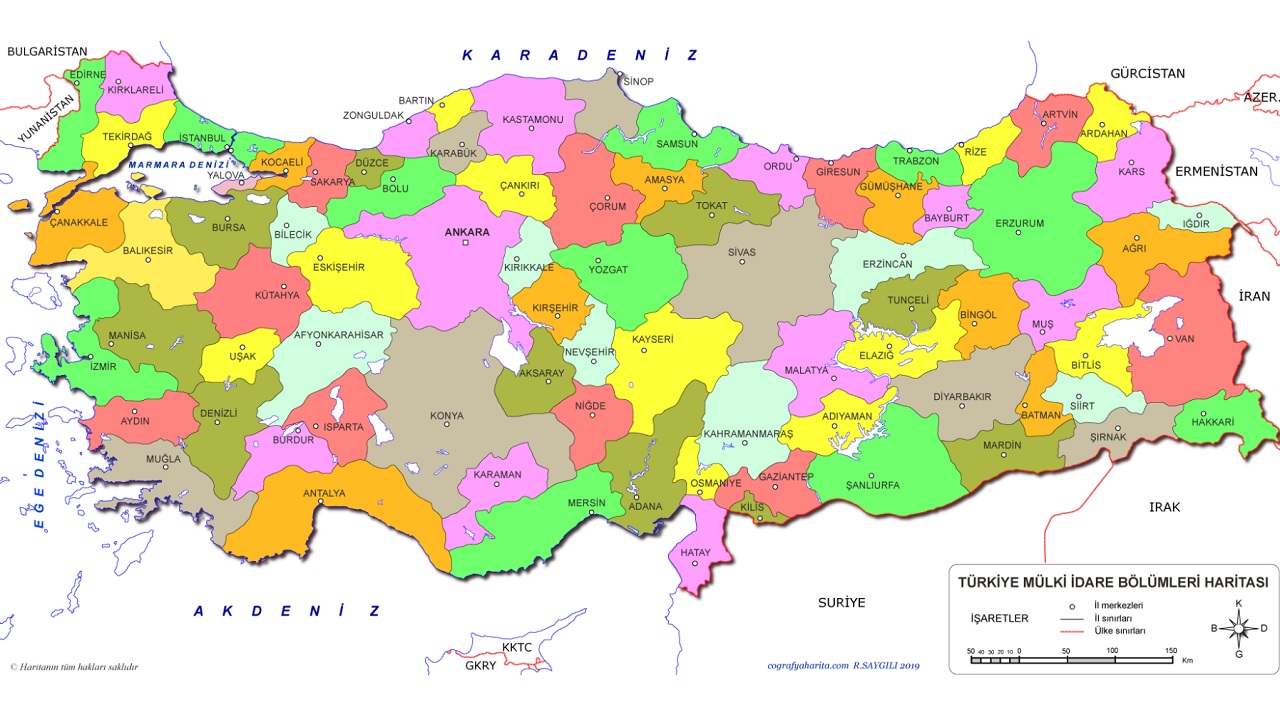
This is how our beautiful country in which we live looks on a political map. You can access the high resolution version of the political map of Turkey via the link here.
How many countries are there in the world? All countries by continent:
- Africa
- Angola
- Western sahra
- Benin
- Botswana
- Burkina Faso
- Burundi
- Algeria
- Djibouti
- Chad
- Congo DC
- Equatorial Guinea
- Eritrea
- Ethiopia
- Morocco
- Ivory Coast
- Gabon
- Gambia
- Ghana
- Guinea
- Guinea-Bissau
- South Africa Republic
- Cameroon
- Cape Verde Islands
- Kenya
- Comoros
- Republic of the Congo
- Lesotho
- Liberia
- Libya
- Madagascar
- Malawi
- Financial
- Mauritius
- Mauritania
- Mozambique
- sweetcorn
- Namibia
- Niger
- Nigeria
- Central African Republic
- Rwanda
- Sao Tome and Principe
- Senegal
- Seychelles Islands
- Sierra Leone
- Somalia
- Sudan
- Esvatini
- Tanzania
- Togo
- Tunisia
- Uganda
- Zambia
- Zimbabwe
- Asia
- Afghanistan
- Azerbaijan
- Bahrain
- Bangladesh
- Bhutan
- United Arab Emirates
- Brunei
- Chinese
- East Timor
- Indonesia
- Armenia
- Philippines
- Palestine
- South Korea
- Georgia
- India
- Iraq
- Iranian
- Israel
- Japan
- Train
- Kazakhistan
- Kyrgyzstan
- North Korea
- Malaysia
- Nepal
- Uzbekistan
- Pakistan
- Russia
- Singapore
- Sri Lanka
- Syria
- Tajikistan
- Thailand
- Turkey
- Turkmenistan
- Vietnamese
- Yemen
- Europe
- Andorra
- Germany
- Albania
- Austria
- Belgium
- Belarus
- United Kingdom
- Bosnia and Herzegovina
- Bulgaria
- Czech Republic
- Denmark
- Estonia
- Faroe Islands
- Finland
- France
- Holland
- Croatia
- Ireland
- Spain
- Sweden
- Switzerland
- Italy
- Iceland
- Montenegro
- Kosovo
- Turkish Republic of Northern Cyprus
- Latvia
- Liechtenstein
- Lithuania
- Luxembourg
- Hungary
- North Macedonia
- Malta
- Moldova
- Monaco
- Norway
- Poland
- Portugal
- Romania
- Russia
- San Marino
- Slovakia
- Slovenia
- Serbia
- Turkey
- Ukraine
- Greece
- South America
- Argentina
- Bolivia
- Brazil
- French Guiana
- Guyana
- Colombia
- Ecuador
- Paraguay
- Suriname
- Uruguay
- Venezuelan
- Chile
- Peru
- North America
- US Virgin Islands
- United States of America
- Antigua and Barbuda
- Aruba
- Bahamian
- Barbados
- Belize
- Bermuda
- Cayman Islands
- Dominica
- Dominican Republic
- El Salvador
- Grenada
- Greenland
- Guadeloupe
- Guatemala
- Haiti
- Netherlands Antilles
- Honduras
- Jamaica
- Canada
- Costa Rica
- Cuba
- Martinique
- Mexican
- Montserrat
- Nicaragua
- Panama
- Puerto Rico
- Saint Kitts and Nevis
- St. Lucia
- Saint Vincent and Granada
- Saint-Pierre and Miquelon
- Trinidad and Tobago
- Turks and Caicos Islands
- Oceania
- New Caledonia
- Australia
- Tongan
- Vanuatu
- Nauru
- New Zeland
- Fiji
- Tuvalu
- Samoa
- Solomon Islands
- Kiribati
- Papua New Guinea
Some countries may be located on more than one continent due to the width of their borders.
All cities by region in Turkey:
- the Mediterranean region
- Adana
- Antalya
- Burdur
- Hatay
- Isparta
- Myrtle
- Osmaniye
- Some districts of Konya
- Some districts of Kahramanmaraş
- Some districts of Karaman
- Some districts of Afyonkarahisar
- Some districts of Denizli
- Some districts of Gaziantep
- Some districts of Niğde
- Eastern Anatolia Region
- ache
- Ardahan
- Bitlis
- Bingol
- Elazig
- Erzincan
- Erzurum
- Hakkari
- Iğdır
- Kars
- Malatya
- Mus
- Sirnak
- Tunceli
- van
- Aegean Region
- Izmir
- Manisa
- Intellectual
- Denizli
- Mugla
- Afyonkarahisar
- Kütahya
- Servant
- Southeast Anatolia Region
- Gaziantep
- Diyarbakir
- Sanliurfa
- Batman
- Adiyaman
- Siirt
- Mardin
- Report
- Sirnak
- Central Anatolia Region
- Ankara
- Konya
- Kayseri
- Eskisehir
- Sivas
- Kirikkale
- Aksaray
- Karaman
- Kirsehir
- Nigde
- Nevsehir
- Yozgat
- Cankiri
- Marmara Region
- Istanbul
- Edirne
- Kirklareli
- Tekirdag
- Canakkale
- Kocaeli
- Yalova
- Sakarya
- Bilecik
- Bursa
- Balikesir
- black Sea region
- Amasya
- Artvin
- Bartin
- Bayburt
- Divided
- Corum
- Duzce
- Gumushane
- Giresun
- Karabuk
- Kastamonu
- Army
- Rize
- Samsun
- Sinop
- slap
- Trabzon
- Zonguldak
Some cities may be located in more than one region due to the width of the border.
Talking about political maps showing the borders of countries and cities and important water resources Via Turkey and World political map We talked about countries and cities. Since political maps show the most up-to-date borders and other important features, if you are going to do important work, do not neglect to use a political map prepared in the same year.