
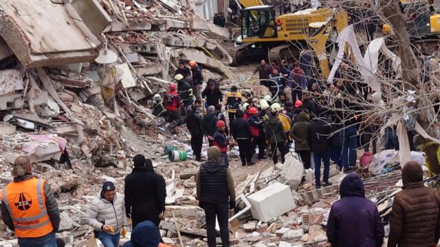
The results of the 7.7 and 7.6 magnitude earthquakes in Kahramanmaraş are starting to come to light. Aerial images after earthquakes that the fault rupture extends for kilometers showed. This once again revealed how devastating the earthquake was.
Fault break stretches for miles
Two major earthquakes, the epicenter of which was determined as Pazarcık and Elbistan, caused great damage in 10 provinces. Photos taken in Tevekkeli village of Kahramanmaraş showed the magnitude of the earthquake. Earthquakes that cause the road to slide 3 meters to the side are described in the literature as “Gölbaşı-Türkoğlu segmentknown as “.
Making statements on the subject, İzmir Dokuz Eylül University (DEÜ) Earthquake Research and Application Center (DAUM) Director and Geological Engineering Department Lecturer Prof. Dr. Hasan Sözbilir stated that the road on the Gölbaşı-Türkoğlu line and the houses around it were destroyed.
Websites where earthquake victims can get help!
We have compiled websites developed by citizens where earthquake victims can easily access and get help.
Previously, 2 units departed from Şanlıurfa and Batman for Kahramanmaraş Pazarcık. Bayraktar AKINCI TİHAhad taken off for mission flights. Bayraktar AKINCI TİHAs carried out non-stop mission flights for detection, search and rescue support and coordination activities in harsh weather conditions on the first day of the earthquake.
The number of Bayraktar AKINCI and Bayraktar TB2 flying missions increased. Since the first day of the earthquake, Bayraktar AKINCI and Bayraktar TB2s, which are in the inventory of the TAF (KKK, DZKK, HVKK), the Ministry of Interior (JGK, EGM) and Baykar, have been deployed to the crisis desk for damage assessment, search. It provides uninterrupted snapshots and data for recovery support and coordination activities.