From Friday afternoon, the storm “Zeynep” will cause considerable disruption to rail traffic, especially in northern Germany and North Rhine-Westphalia.
(Photo: imago images/Hanno Bode)
Berlin In view of the impending storm “Zeynep”, Deutsche Bahn advises passengers to bring forward their trips planned for late Friday afternoon if possible. “Substantial disruptions to rail operations are to be expected from the afternoon hours,” the company said on Friday in Berlin. Then the next storm front will reach Germany. It has not yet been announced whether, when and where operations will be discontinued.
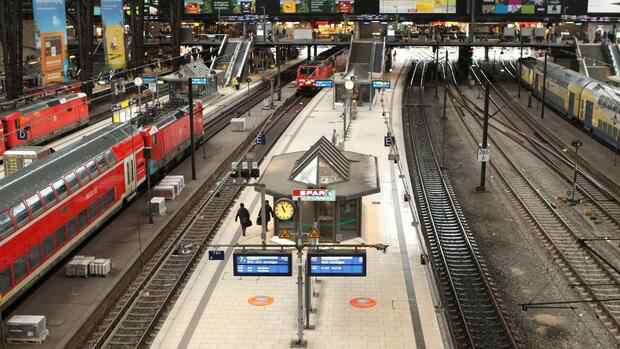
The railway is gradually discontinuing regional traffic in parts of northern Germany and North Rhine-Westphalia due to the announced storm. The company announced this for the course of the day in Schleswig-Holstein, Lower Saxony, Hamburg, Bremen and parts of NRW.
Long-distance traffic is also to be phased out. For the rest of the day, there will be no more long-distance trains north of Dortmund, Hanover and Berlin, the company said. No long-distance trains ran all day on the connections from Amsterdam to Berlin and Frankfurt.
The protection of travelers and employees has priority, it said. The German Weather Service warns of severe weather with extreme hurricane gusts and hurricane-like gusts, especially for the northern parts of the country and for central Germany from the afternoon.
Top jobs of the day
Find the best jobs now and
be notified by email.
“Whoever can, we recommend traveling by train from the late afternoon to an earlier time,” recommended the railway. Passengers can use their tickets booked for the period from Thursday to Sunday flexibly until February 27 or cancel free of charge if they postpone trips because of the storm.
With the new storm low, wind speeds that are sometimes significantly higher than on Thursday with hurricane low “Ylenia” can be expected. During the storm, the railway temporarily stopped operating in northern Germany on Thursday morning. According to the company, four fifths of the long-distance trains are now running, and 80 percent of the stops are on time.
>> Read about this: When insurance companies pay for storm damage
The consequences of hurricane “Ylenia” are still visible in northern Germany. After the storm on Thursday, the fish market in Hamburg’s Altona district was flooded again early Friday morning. According to the Federal Maritime and Hydrographic Agency (BSH), the water level at the St. Pauli measuring point was 1.49 meters above the mean high water level – one centimeter below the limit for storm surges.
For Saturday, the BSH expects water levels of up to three meters above the mean high water, which corresponds to a severe storm surge. The maximum is expected to be reached early Saturday morning.
There is a storm surge warning for the German North Sea coast
In order to avoid damage and accidents, citizens should make appropriate preparations before the next storm. “Everything that is on the terrace that is not nailed down is best brought in and put in the garage,” said Christopher Rehnert, head of the Lüdenscheid fire brigade, on Friday morning in the ARD “Morgenmagazin”. Flower boxes or other items should be removed from balconies.
In some places, school lessons are likely to be affected again on Friday – as in some cases on Thursday – or be canceled completely. The district of Goslar in Lower Saxony announced that the students could not be promoted everywhere. Therefore, face-to-face classes in all general and vocational schools were canceled there. From Hamburg it was said that those with custody can decide for themselves whether their child stays at home, but they should then inform the school.
The fish market on the Elbe was flooded on Thursday.
(Photo: dpa)
For the German North Sea coast, warnings of storm surges are again being issued for Friday. A spokesman for the Federal Maritime and Hydrographic Agency (BSH) said that storm surges are quite normal in themselves, but unusual in the frequency they are at the moment.
On the North Sea coast, one speaks of a storm surge when the flood water is at least 1.5 meters higher than normal. A severe or very severe storm surge is only spoken of from values of 2.5 or 3.5 meters.
Hurricane “Ylenia” led to thousands of operations
Hurricane low “Ylenia” had already led to thousands of operations since Wednesday evening. Many trees fell, there were accidents on the roads with some dead and injured, and rail traffic in the north came to a standstill in large parts. The Berlin fire brigade alone deployed around 1,300 missions by Thursday evening.
At least three drivers in Lower Saxony and Saxony-Anhalt died in weather-related accidents – two were killed by falling trees, a third died when his trailer got into the oncoming lane in a storm and an accident occurred.
An incident for the people on a Hamburg harbor ferry went off lightly: On a stormy trip across the Elbe on Thursday morning, a large wave smashed the front windows of the ship. According to police, three passengers suffered minor injuries.
London warns of mortal danger from storm
Other European countries are also preparing for the next hurricane: millions of people in the British capital, southern England and Wales were asked to stay at home on Friday because of the stormy weather.
As the British weather service Met Office announced, there is a risk of death due to flying debris at storm speeds of up to 130 kilometers per hour. Covered roofs, uprooted trees and disturbances in train and ship traffic are to be expected. People on the coast have been warned of large waves and flooding.
Britain braced for the arrival of storm Eunice, dubbed Zeynep in Germany, on Friday. According to the BBC, it could be one of the strongest storms to hit the country in decades. In Ireland, strong winds had already caused power outages in thousands of households during the night.
Heir to the throne Prince Charles had canceled a visit to Wales because of the warnings. Storm “Dudley”, which is called “Ylenia” in Germany, had already led to serious disruptions in train traffic in Scotland and the north of England on Thursday night. Thousands of homes across the north of England have been left without electricity.
France warns of four meter high waves on the coasts
France and the Netherlands are also preparing for the approaching storm. In France, the weather service has issued a severe weather warning for five departments in the north. Wind speeds of up to 140 kilometers per hour and waves up to four meters high on the coast threatened, the weather service said on Friday morning.
In the Netherlands, the most severe level of the weather alarm, code red, applies to large parts of the country. The weather service KNMI warned on Friday of “dangerous situations” caused by very heavy gusts of wind with speeds of up to 130 kilometers per hour.
The French railways announced that they would stop regional traffic in the north and in Normandy from midday, with a few exceptions. Disabilities were also expected in eastern France. The TGV trains should run as planned, but the high-speed Thalys not to the Netherlands.
In the Netherlands, the weather alert applies in particular to the coastal provinces in the west, the north and the regions around the IJsselmeer and the Wadden Sea. From around 2 p.m. the storm will reach the Netherlands. In the evening, the wind will then weaken, as the experts estimate. As a precaution, train traffic should be stopped after 2 p.m., many schools will be closed. Impairments were also expected for air traffic: Amsterdam Airport Schiphol announced cancellations and delays. Because of the storm, many vaccination and test centers should also be closed in the afternoon.
More: Violent storm moves over Germany – pictures of the storm