
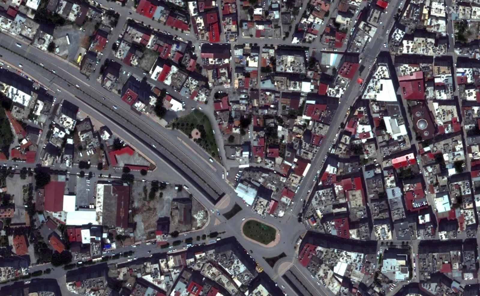
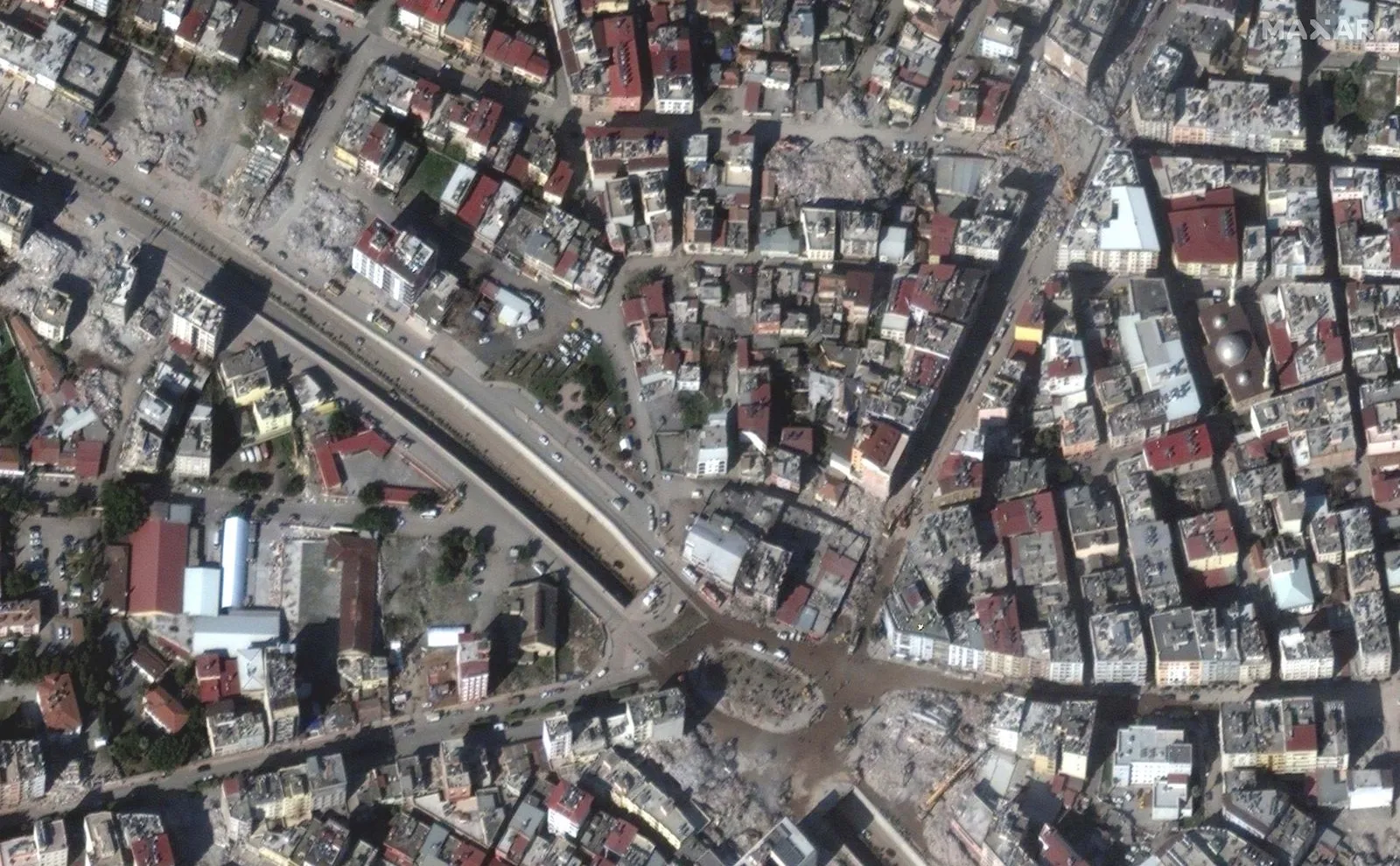
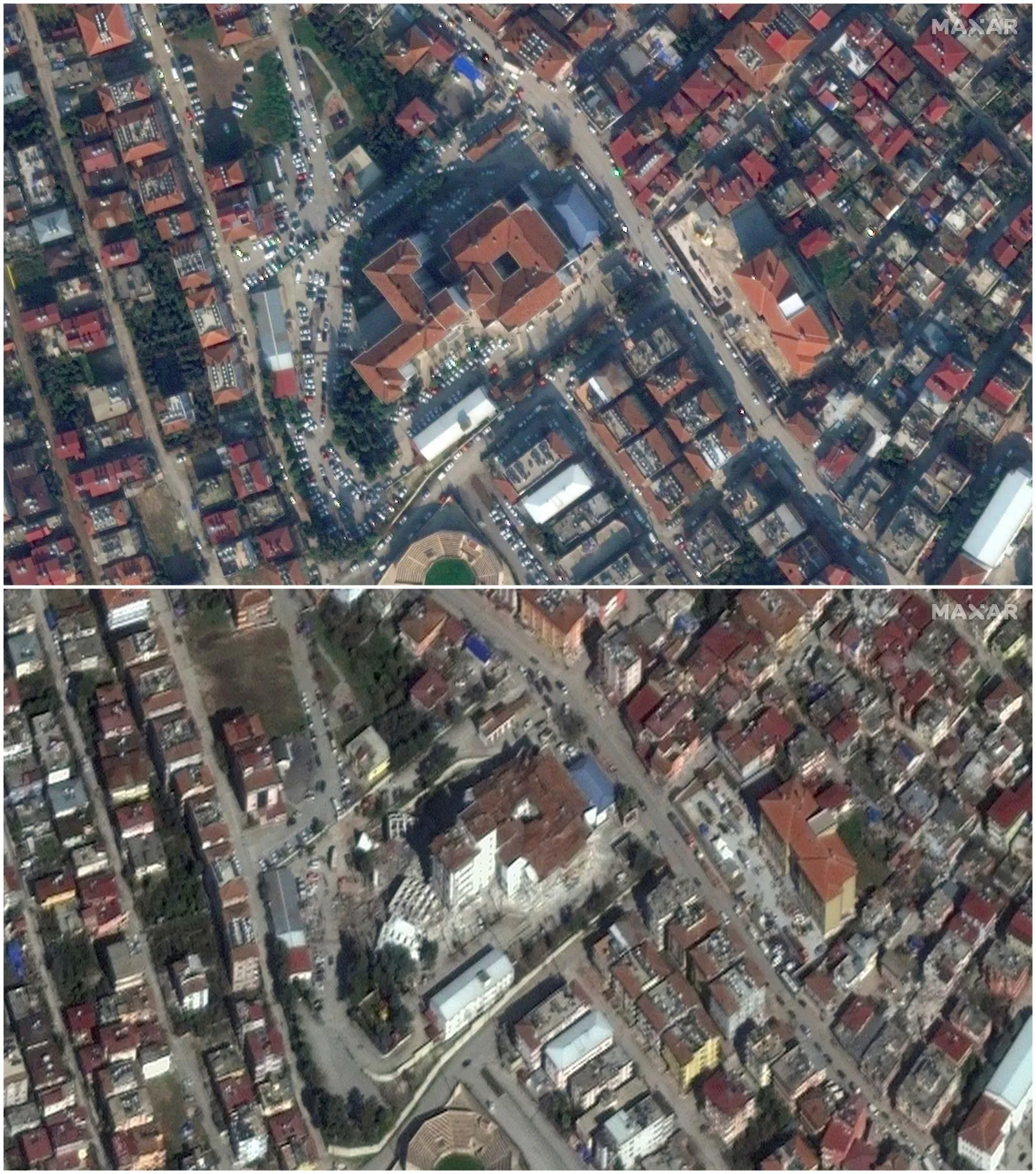
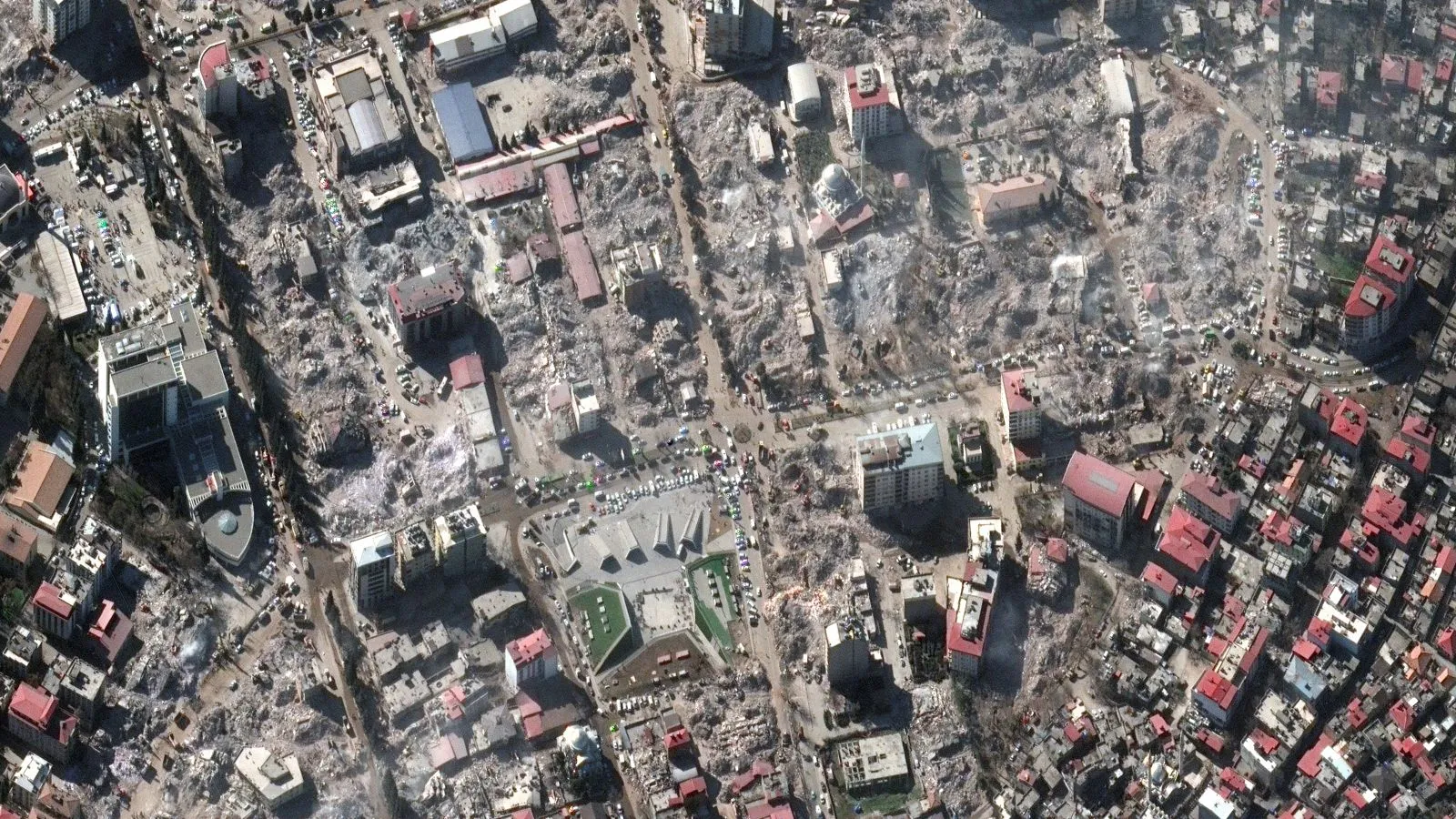
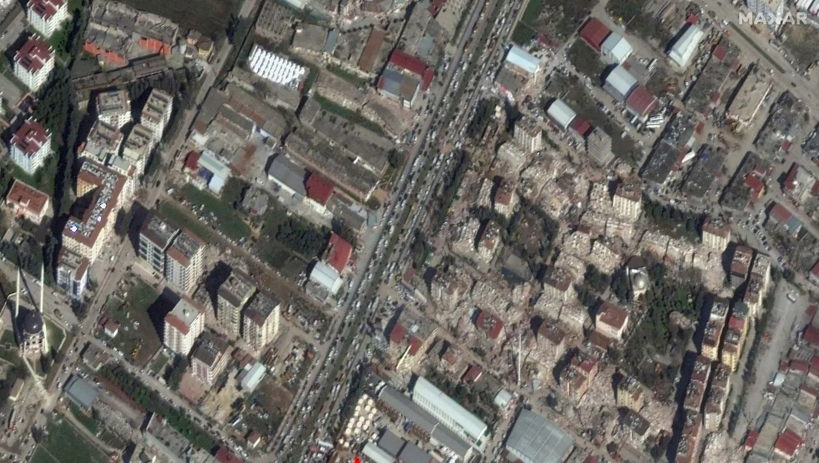
On February 6, the 7.7 magnitude earthquake in Kahramanmaraş and then the 7.6 earthquake disasters at noon caused great wounds. As the days passed, the extent of the destruction became better understood. Satellite images also show how big this disaster was.
Maxar captured the disaster
The US-based company Maxar shared satellite images of the earthquake on social media. The company revealed the destruction caused by the earthquakes that caused the destruction of 10 provinces in Turkey.
Earthquake risk continues to grow in our country. The General Directorate of Mineral Research and Exploration (MTA) published a renewed active fault line map after the events. In Turkey, there are 110 districts on the area of 45 provinces located on an active fault. The number of active faults that can produce earthquakes of 5.5 and above in our country is 485.
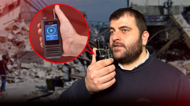
Communication by radio instead of telephone in earthquake! (Video)
As an alternative to the collapsed GSM networks after the earthquake, you can communicate by radio instead of telephone.
AFAD numbers for earthquake zones;
-AFAD Diyarbakir: 0412 326 1156
-AFAD Hatay: 0326 112 0000
-AFAD Maras: 0344 221 4991
-AFAD Antep: 0342 428 1118
-AFAD Adana: 0322 227 2854
-AFAD Adiyaman: 0416 216 1231
-AFAD Urfa: 0414 313 7290
-AFAD Malatya: 0422 212 8432
-AFAD Mardin: 0482 212 3740