The German Weather Service issued a severe weather warning until Thursday evening.
(Photo: imago images/Future Image)
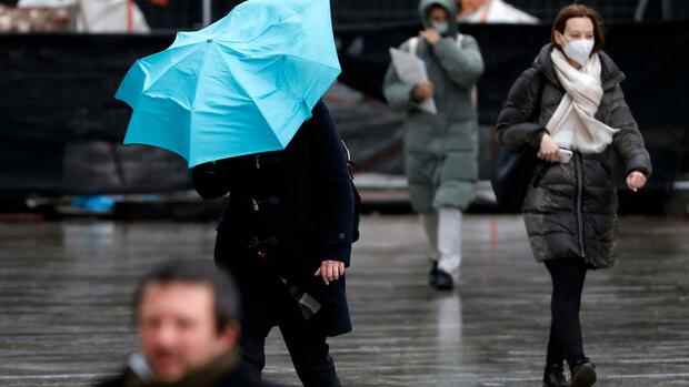
Offenbach/Hamburg Less than three weeks after storm “Nadia”, two hurricane lows set course for Germany. The German Weather Service (DWD) in Offenbach issued severe weather warnings for Wednesday evening to Thursday evening, mainly for the northern half of the country. Police and rescue workers prepared for a stormy night on Wednesday evening.
Air traffic is also affected by the weather conditions. Lufthansa has so far canceled 20 flights as a precaution, as the company announced during the night on request. Passengers are advised to check the airline’s website for the status of their flight. According to the operator, connections to Berlin, Hamburg and Munich are affected at the largest German airport in Frankfurt.
There was a risk of a storm surge on the North Sea. Deutsche Bahn advised to find out about delays or train cancellations. In North Rhine-Westphalia, state school minister Yvonne Gebauer (FDP) canceled classes for Thursday. The first foothills of the storm coming from the west caused heavy wind and rain on Wednesday evening – without causing much damage. Fire brigades in East Friesland called on coastal residents to secure garden furniture and garbage cans.
In the evening, the wind from low “Ylenia” should pick up powerfully, sometimes it could reach hurricane strength. Authorities urged caution because of falling trees. As in North Rhine-Westphalia, schoolchildren in several regions of Lower Saxony or Bavaria are allowed to stay at home on Thursday because of the weather hazards.
Top jobs of the day
Find the best jobs now and
be notified by email.
“It starts in the northwest and then moves southeast to about the middle of Germany,” explained DWD meteorologist Adrian Lyser. Gusts with a speed of up to 120 kilometers per hour are possible. In some regions, the predictions went even further: “Up to 140 kilometers per hour will be possible on the Brocken,” said DWD expert Manno Peters. There have already been several stronger storms this winter. “But we haven’t had a storm like this for a long time,” emphasized the meteorologist.
According to the DWD, the wind from low “Ylenia” will slowly decrease from Thursday afternoon. However, the breather should only be brief. The next hurricane – called “Zeynep” – is expected to come from the British Isles as early as Friday afternoon.
Danger of a storm surge on the North Sea coast
According to the DWD, the northern half in particular will probably be affected again. But the forecasts are not entirely certain: “The models still have very different simulations,” said press spokesman and meteorologist Andreas Friedrich on Wednesday. The weather situation is very dynamic.
The Federal Maritime and Hydrographic Agency (BSH) warned of the danger of a storm surge at night for the German North Sea coast. On the East Frisian coast, the high tide should be about one meter higher than the mean high tide; on the North Frisian coast and in the Weser and Elbe area about 1.5 meters higher than normal. In the Hamburg Elbe area, the flood should reach values that are 1.5 to 2 meters higher than the average flood. The storm surge danger exists until around 5 a.m. on Thursday morning. The highest water level in Hamburg is expected around this time. Then the fish market in Altona should be partly flooded – like a few times this year. On Wednesday evening, the police described the situation as calm.
Floods were also warned in Thuringia, for example in parts of Sonneberg. “Bring personal valuables to higher parts of the building. Turn off power and heaters in at-risk spaces. There is already a risk of electric shock with condensation,” said a statement from the Thuringia state police department in the evening. People in parts of the city of Schleusingen had already prepared for possible flooding of the Werra tributary lock. Numerous volunteers helped to fill around 2000 sandbags, as the spokesman for the Hildburghausen district office, Tim Pechauf, said.
According to the ADAC in North Rhine-Westphalia, motorists should leave their cars where they are and avoid trips that are not absolutely necessary. Fallen trees or branches must be expected at any time. Deutsche Bahn announced that goodwill regulations for the validity of long-distance tickets already purchased would apply for the Thursday/Friday period. More flexible use over several days or free cancellations are possible. In some regions in the north, the first train connections have been cancelled. It was also said from Mecklenburg-Western Pomerania that trains would sometimes run at reduced speeds.
Berlin warns against entering parks
Airports closely monitored the weather development and made devices, for example, weatherproof and windproof. “We make sure that the brakes on all luggage trolleys are on, that there are no more pylons standing around and that everything that could fly around is covered,” said Berlin airport spokesman Jan-Peter Haack.
The Mitte district of Berlin warned “expressly and urgently” against entering parks because of rotten trees. Numerous zoos, for example in Berlin, Wuppertal in North Rhine-Westphalia and in Magdeburg (Saxony-Anhalt), should remain closed on Thursday as a precaution. Visiting cemeteries was forbidden here and there. Many ski areas also prepared for the hurricane lows. The Fichtelberg suspension railway in Saxony was already standing still on Wednesday. Because of the risk of tree breakage, some trails are to be closed. In many cities, the weekly markets for Thursday have been canceled.
In Scotland, where experts also expected the storms to have severe effects, train and ferry services were shut down. Tourist attractions such as Edinburgh Castle have been closed.
At the end of January, the storm “Nadia” swept through northern and eastern Germany with dangerous gusts, causing millions in damage. In Beelitz, Brandenburg, a pedestrian died because a large election poster was blown over and fell on him. About a week later, the foothills of storm “Roxana” swept over parts of Germany.
According to the DWD meteorologist Friedrich, the expected storms are comparable to low “Nadia” in terms of wind peaks. From his point of view, however, the current situation is more explosive, “because we have a chain of storm lows”.