
Starlink, part of Elon Musk’s SpaceX project, is in earth orbit 5 thousand 600It provides fast internet with more than 100 active satellites. If you are wondering what the network formed by these satellites looks like, a website now offers you this opportunity. This site shows the Starlink fleet in real time and offers interesting details of each satellite. So how and where to watch?
How and where to watch live satellite with Starlink map?
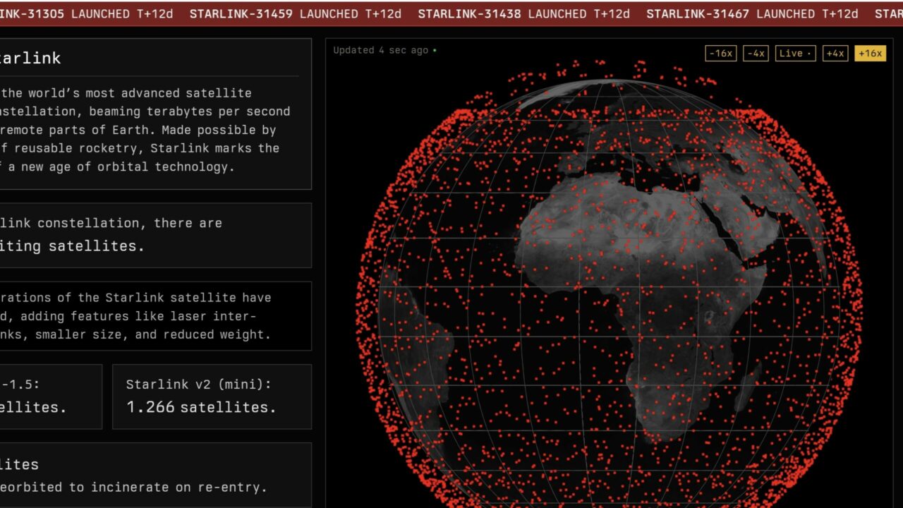
starlinkmap.organ The website shows the Starlink Map in a zoomable and rotatable 3D view of Earth. If you log in to the site with a phone or tablet, you may need to turn your device sideways.
On the Starlink live satellite map, each satellite is represented by red dots. You can see the numbers of different satellites by hovering your mouse cursor over the Earth and click on them to get individual information about each.

Amazon gave a date for satellite internet to rival Starlink!
Amazon begins prototype testing for Project Kuiper. Satellite communications and terminals will be tested during the six-month period.
More general information about the Starlink fleet is detailed alongside the map. For example, it includes data such as when the last Starlink mission was, which major companies own how many Starlink satellites, and how many of these satellites have already been destroyed.
These satellites, called Starlink-4038, Starlink-5981 or Starlink-1147, have a single mission: to provide fast internet to the customers of Elon Musk’s SpaceX project. Musk is currently traveling to space for his service. 5 thousand 600 active satellites has been placed; together these form a network of celestial bodies.
Starlink live satellite map is operated and independently run by American programmer Will DePue. DePue uses Celestrak and space-track.org services as data sources. DePue takes inspiration from heavens-above.com for his 3D visualizations.
Heavens Above is operated by Chris Peat and supported by the German Aerospace Center (DLR). The Starlink Map and other related tools contribute to a better understanding of this impressive network in space, providing comprehensive information for those interested in satellite observation and space technologies.
Technologies and tools such as the live Starlink satellite map stand out as valuable resources for amateur observers and experts alike. So what do you think about this issue? Do you think this is a useful development? You can write your opinions in the comments section below.