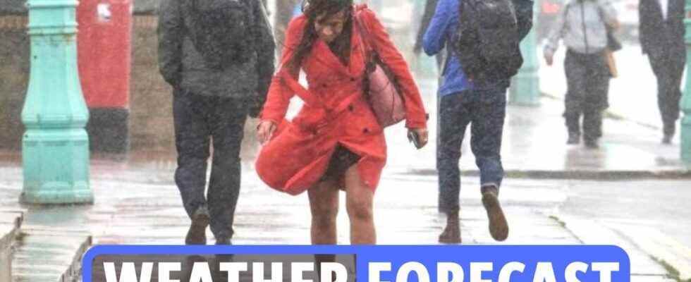
FLOODING is expected to hit Britain in the coming days as an Arctic blast edges closer – bringing with it heavy rain, gale force winds and freezing overnight temperatures.
Yesterday saw torrential rain sweeping across the country, with more wet weather set for this evening as a dreary January well and truly sets in.
And the bookies now make it just 5/2 for this month to enter the record books as the wettest January ever after flood alerts were today issued across the UK.
Alex Apati of Ladbrokes said: “There’s every chance this month breaks January records for all the wrong reasons, with more miserable weather on the way.”
For today, a Met Office forecast says: “Mostly cloudy, cloud thick enough for some rain or drizzle at times, mainly in the north and west. Mostly dry in the southeast where some brighter spells. Milder than Sunday.”
.Read our weather live blog for the latest news and forecasts
-
Late January to early February forecast
Conditions expected to remain broadly unsettled and changeable through this period with occasional spells of wet and windy weather moving across from the Atlantic.
Western and northwestern parts likely to see the wettest and windiest conditions overall whilst eastern and southeastern parts probably seeing the most of any drier spells.
Temperatures likely to be slightly above average overall throughout but there remains a possibility of short-lived colder spells.
Colder spells likely to bring a risk of snow at times, though mostly over high ground in the north.
-
Weather outlook for Tuesday to Thursday
The Met Office has offered a short summary into the weather for next week.
It predicts how there will be “cloud and rain for England and Wales Tuesday, clearing southeast; sunny spells elsewhere with a few showers far northwest”.
The agency added it will be “settled and mostly dry Wednesday onwards, with overnight frost and fog”.
-
How to stay warm when outside
With the weather getting chillier and frostier, you’ll want to wrap up warm.
Here are some good tips for staying all snugly and cosy when outdoors:
- Prewarm your clothes.
- Invest in some quality thermals.
- Fleece leggings.
- Hand warmers.
- Cover every inch of skin.
- Eat fatty foods.
- Thermal flask.
- Keep moving.
- Keep hydrated.
- Keep your head covered.
- Tactical scarf-wearing – including keeping your nose and mouth covered
-
Odds slashed on January being wettest EVER
Ladbrokes have slashed the odds on this month going down as the wettest January EVER.
Having been a 4/1 shot last week, the bookies now make it just 5/2 for this month to enter the record books, with flood alerts being issued across the UK.
Alex Apati of Ladbrokes said: “There’s every chance this month breaks January records for all the wrong reasons, with more miserable weather on the way.”
-
Drivers face £100 fine for wearing wrong shoes during snow
Thicker boots may keep your feet warm in the snow but they could get you into trouble and you with a heavy fine if you drive in them.
While wearing inappropriate shoes to drive isn’t technically illegal, careless driving due to unsuitable footwear can get you into trouble.
Rule 97 of the Highway Code states that before heading off on a drive, you must ensure that “clothing and footwear do not prevent you using the controls in a correct manner”.
If you are stopped by the police for careless driving and they decide your footwear caused the problem, you can face up to a £100 on-the-spot fine plus penalty points on your licence.
If you do need heavier boots for snow or cold weather conditions when you’re out and about, it’s best to take an additional, safer pair of shoes to drive in too.
-
When is it too cold to go to work?
Snow and ice have reappeared across Britain after a record mild spell to start the new year.
And though everyone loves a snow day, there’s unfortunately no guarantee of a day off school or work just because it’s snowing.
There is also no specific law around minimum or maximum working temperatures, although there are guidelines.
If it is safe and reasonable to travel to work, then you should do so.
But if it isn’t safe, contact your employer and check the company handbook.
Keep in mind that government guidance in all four UK nations currently advises you should work from home if it’s practical, too.
-
Tuesday weather summary for London
Here’s a short but helpful summary from the Met Office for what to expect in London tomorrow.
The capital will remain “generally cloudy with outbreaks of rain and drizzle, becoming lighter and more intermittent in the afternoon, before clearing southeastwards in the evening”.
“Light winds. Maximum temperature 10 °C,” the summary added.
-
Cloudy skies and rain will continue this evening
Its looking like tonight’s weather will see dull and wet conditions continue, according to a Met Office forecast.
The weather agency tweeted: “Has this afternoon’s weather hindered your search for some MondayMotivation?
“There’s little change this evening with cloudy skies continuing for most of us, and some rain and drizzle in places.
“Gales across Shetland easing but staying rather windy in northern Scotland.”
-
Pictured: Sunrise over Castle Hill, Cambridge
The sunrise over Cambridge from Castle Hill is pictured below.
Over the next few days much the country is expected to have relatively settled weather with temperatures slightly high than usual for this time of year.
However, forecasters have warned of an Arctic blast, with it odds on with the bookies to be the wettest January on record.
NINTCHDBPICT000704358304Credit: SWNS
-
Tuesday’s weather in a nutshell
Here’s another short weather summary courtesy of the Met Office.
Sunny intervals and showers across northern Scotland, where remaining windy.
Rain and cloud slowly clearing to sunnier skies, though far southeast likely cloudy all day.
-
Met Office weather outlook for Wednesday to Friday
The Met Office has offered a summarised glimpse into weather for the latter half of this week.
It says conditions will be “settled across many areas with sunny spells, overnight frost and morning fog patches, stubborn to through the day”.
The weather agency adds that it will be “milder and windier over northern Scotland, with rain mainly over western hills”.
-
Weather outlook for this evening
Here is a short summary of tonight’s weather across the UK.
The Met Office says: “Rain, drizzle and low cloud continuing across many southern areas where mild.
“Clearer weather spreading to most northern areas but with strong winds and showers in west and north Scotland.”
-
Today is 40th anniversary of coldest ever recorded UK temperature
Today is the 40th anniversary of the coldest ever UK temperature on record.
A shivering -27.2C was recorded in Braemar, Aberdeenshire on January 10 1982.
The minimum temperature equalled the previous lowest officially recorded temperature in Britain – which was also set at Braemar on 11 February 1895.
-
Odds slashed on January being wettest EVER
Ladbrokes have slashed the odds on this month going down as the wettest January EVER.
Having been a 4/1 shot last week, the bookies now make it just 5/2 for this month to enter the record books, with flood alerts being issued across the UK.
Alex Apati of Ladbrokes said: “There’s every chance this month breaks January records for all the wrong reasons, with more miserable weather on the way.”
-
Pictured: Water cascades down Derwent Dam in Derbyshire
Water cascades down the face of Derwent Dam this morning in Derbyshire after recent snow fall melted & raised water levels.
The Dam was used by 617 Squadron the “Dam Busters” to practise low level flying in preparation for Operation Chastise during the Second World War.
The Met Office forecast states today there will be a few foggy or frosty spots in the east at first.

NINTCHDBPICT000704364047Credit: LNP
-
Brits in for some colder nights, says forecaster
Annie Shuttleworth a Met Office forecaster said: “It will be a largely cloudy day across the UK on Monday as rain and mild air pushes eastwards throughout the day.
“Further west, in central and western areas, quite a cloudy night with outbreaks of rain and drizzle across western areas. That could be quite persistent on Monday morning, with some hill snow in the far north of Scotland.
“We’re in for some drier weather, but some colder nights and some foggy nights too.”
-
What can we expect from this weekend’s weather?
Frost and fog are also predicted for the end of the week, with freezing fog rolling across the nation, causing severe disruption for commuters, a spokesperson for The Met Office said.
Meanwhile, there are three flood alerts in place across England across the southwest, after eleven flood alerts were originally issued over the weekend.
-
Met Office: Freezing conditions to come round quickly
The Met Office said conditions are surprisingly mild for the time of year but that Brits should expect freezing conditions to come around very quickly.
Met Office forecasters are predicting dull and dreary days before the brutal drop in temperature heading into next week, with London temperatures lower than Scotland.
While mild spots are expected across the UK, with London and Edinburgh peaking at 10C, the sudden plummet will leave people feeling frosty this weekend.
But the big freeze will hit the whole of the UK from Wednesday onwards with temperatures dropping as low as 0C in London.
-
10 dead in South African coastal city from flooding
Floods around South Africa’s eastern coastal city of East London have killed at least 10 people and left hundreds homeless since the weekend, national media reported on Monday, as rivers burst their banks and roads were inundated.
Footage on state broadcaster SABC showed cars trying to drive through torrents of water that had submerged highways. Several media reported that hundreds of homes had been washed away in the iron-roof informal settlements just outside the city, especially the Mdantsane township.
Scientists suspect that climate change is the cause of worsening floods and droughts along the country’s eastern coastline, where the city of roughly half a million lies.
In 2019, the Department of Environment drew up a plan for South Africa to adapt to climate change, which includes strengthening its preparedness to respond more quickly to weather disasters and help victims recover.
-
Met Office: Temperatures to fall this week
The Met Office tweeted: “It’s much #milder in the north and west today
“However #temperatures are set to fall in most places this week.
“Feeling #cold in the south by Friday but remaining mild in the north.”
-
Some areas could see up to 13cm of snow
The highest levels of snow will be seen in Pitlochry this morning, which could see up to 13cm, the Express reports.
Parts of the northeast of England, and in particular, the Yorkshire Dales may also see wintry showers as temperatures plunge.
The bone-chilling snow levels are expected to stay throughout the day, according to WXCharts.
And in Scotland, temperatures could drop as low as -3C, while in northern England the mercury may range from 0C to -2C.
The Midlands and south of England will be slightly warmer with highs of 4C.
-
Met Office warns of thick cloud today
The Met Office has today warned of thick cloud, rain and drizzle.
The forecast says: “Mostly cloudy, cloud thick enough for some rain or drizzle at times, mainly in the north and west.
“Mostly dry in the southeast where some brighter spells. Milder than Sunday.”
-
Frost and Fog due to set in next week
Frost and fog is set for the latter end of the week, with freezing fog rolling across England and Wales, a spokesperson for The Met Office said.
The forecaster told The Sun: “We’ve seen pretty much an average start to the month in terms of rainfall, we’re running at about 30 per cent of the average rainfall – we would usually expect to be at that value.
“But high pressure building and fog will be the main problem.
“It looks quite nice around the middle of the week, and Wednesday could be quite sunny – but there is an increasing risk developing of freezing fog on Thursday and Friday.”
-
Britain saw flooding chaos yesterday
In East Sussex, three people had to be airlifted to safety after getting cut off by high tide and four-metre high waves, the BBC reports.
A spokesperson for the RNLI “strongly urged” beachgoers and water lovers to “check the weather and tides before setting out”.
Yesterday, there were 12 flood alerts in place across the country, with the Environment Agency warning rivers could swell and rise – causing flooding to fields and gardens in some parts.
Today, however, the risk of flooding was reduced to “very low”, with just nine alerts in place.
-
How to stay warm when outside
With the weather getting chillier and frostier, you’ll want to wrap up warm.
Here are some good tips for staying all snugly and cosy when outdoors:
- Prewarm your clothes.
- Invest in some quality thermals.
- Fleece leggings.
- Hand warmers.
- Cover every inch of skin.
- Eat fatty foods.
- Thermal flask.
- Keep moving.
- Keep hydrated.
- Keep your head covered.
- Tactical scarf-wearing – including keeping your nose and mouth covered