Satellite images of earthquakes that did not leave a stone on a stone were shared in Kahramanmaraş and its surroundings. An earthquake expert, who evaluated the displacement, stated that the slip on the fault was 3-4 meters.
As Turkey continues to heal the wounds of the earthquakes that took place on Monday, February 6th, brand new products from the region satellite images it keeps coming. Information obtained from Google Earth and satellite imagery provider Maxar, shows the earthquakes in Kahramanmaraş. how severe it is it reveals.
Now, we will first transfer the shared images about the train tracks, and then the satellite images.
Train tracks bent like “spaghetti”!
https://www.youtube.com/watch?v=aJ39LtgPzG8
The above image is of Kahramanmaraş. from Turkoglu district. It can be easily seen how the train tracks, which should be straight, turn into the letter S. In these images, on the ground You can also see the huge crack.
NOTE: There are various GIFs in the next section of our content. These are taken from Google Earth and Maxar before and after images. The images are taken from the same angles, place of changing that it is caused by the earthquake, the orange colored lines are fault lines Let’s say it represents.
Satellite images are even scarier
Continuing his studies within the German-based Karlsruhe Institute of Technology. earthquake and tsunami expert Andreas Schafer He shared some satellite images on Twitter. While these satellite images reveal the destructiveness of the earthquake, the fault line how you moved also reveals.
Andreas Schafer, due to the earthquake that occurred The faults may have been displaced in the range of 3-4 meters. that he said. In the past days, different local and foreign scientists have made similar statements for the movement of the fault.
The first share of the scientist:
Near Nurdagi clearly visible fault rupture. There should be a displacement of about 3-4 meters.
This is how the broken fault destroyed a grain store:
Andreas Schafer, in the second image he shared, grain store Notice how it was destroyed.
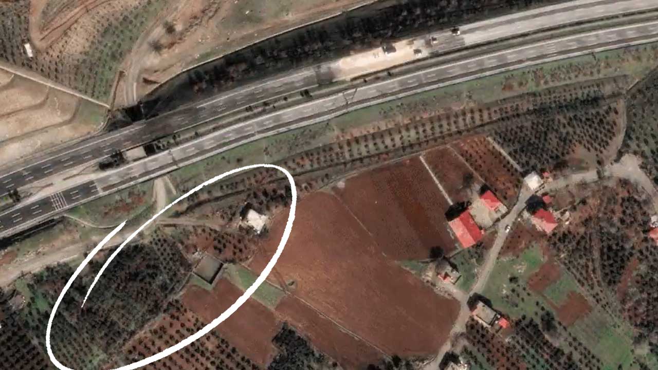
In another satellite image, we see the shift in the direction of the highway:
In the latest satellite image shared by Andreas Schafer, passing by We are witnessing a shift in a fault line. If you look carefully, there is a slight shift in the direction of the road. Also at the bottom of the road fields have slipped…
Before the earthquake:
After the earthquake: