
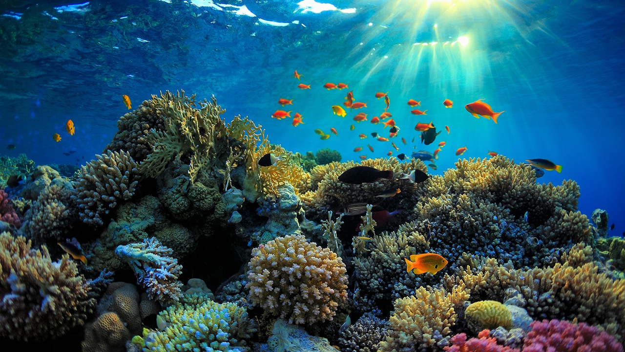
Researchers have succeeded in making a detailed map of the world’s coral reefs for the first time in history. For this, images taken from more than 2 million satellites were brought together in digital environment.
One of the most important structures in the world coral reefs. Coral reefs, which are hit by factors such as global warming and environmental pollution, are also the source of life in the seas. Scientists also aim to determine the current situation first in order to protect these reefs.
co-founder of Microsoft by Paul Allen The Allen Coral Atlas project, named after him, is a guide for the conservation of coral reefs. In addition, this study will also provide guidance for marine life planning and coral research.
A first in the world
In their statement on Wednesday, the team of researchers stated that the atlas was completed and that this map, First high-resolution, spherical example of its kind stated that. In this map, users also learn about structures such as local reefs, underwater structures, sands, stones, sea plants.
maps, up to 15 meters It allows you to see the depth. Thus, it will be a reference in the hands of those who want to work on any region. It will also guide the efforts to support underwater life.
RELATED NEWS
Cows Blamed for Global Warming Could Be Key to Emancipation from Plastic Waste
From Arizona State University, the incumbent Greg Asner, in his statement, stated that the biggest advantage of this success was the drawing of the world map for the first time, while the project progressed with the efforts of volunteers around the world.
The condition of the reefs can be monitored continuously
RELATED NEWS
NASA Developed A Game To Help Mapping Coral Reefs
Project work was first in 2017 Allen’s company, Vulcan Inc. was initiated by Later, Hawaiian researcher Ruth Gates initiated the project with super reef creation studies, Vulcan Inc. and sponsored more studies.
The project was agreed with the satellite company called Planet. 9 million dollars More than 2 million images from satellites were combined by volunteers and artificial intelligence and placed on the map in layers, with Allen at the expense of.
Source :
https://apnews.com/article/technology-climate-environment-and-nature-corals-coral-reefs-6ae12534db7c3c92c94aeed638853908