While many satellite images shared after the earthquake disaster affecting 11 of our cities revealed the extent of the disaster, NASA shared new images that will allow us to look at the region from a different perspective.
After the two major earthquakes that took place on February 6 and affected our 11 provinces, we encountered many images that reveal the gravity and destruction of the situation. Especially incoming satellite images, it was revealing the destruction in cities in every aspect…
After the disaster, in which tens of thousands of our citizens lost their lives and millions of people became homeless, while trying to heal the wounds with aid campaigns organized both in our country and around the world, people from the region new satellite images it keeps coming.
”Dark Nights in Antakya”
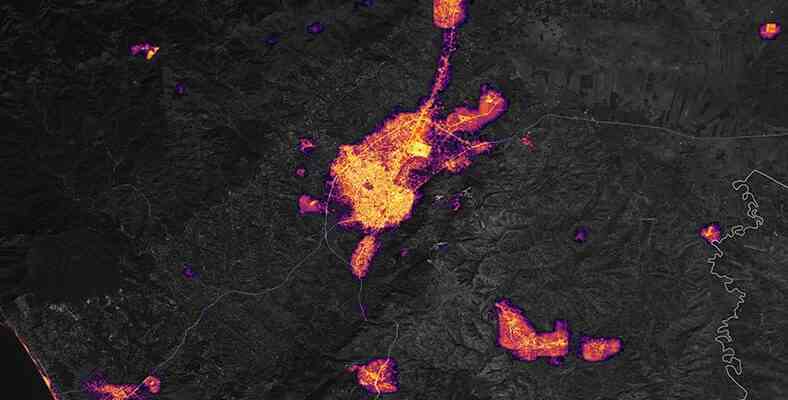
The final images were obtained from the Visible Infrared Imaging Radiometer Suite (VIIRS) aboard the NASA-NOAA Suomi NPP satellite. NASA shared the images with the title ‘Dark Nights in Antakya’
images, How Hatay turned into darkness after the earthquake is showing. The image above, dated February 4, shows the amount of light Hatay emits at night.
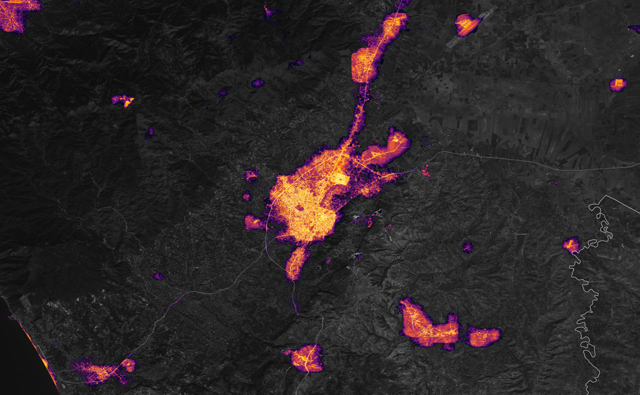
This image dated February 8 is from the earthquake. After 2 days, the amount of light emitted by the city… The regions seen on the map are Dursunlu, Harbiye and Samandağ in the southwest; Gunyazi in the west; Visit in the east; and Alazi districts and neighborhoods in the north. The part in the center is Antakya.
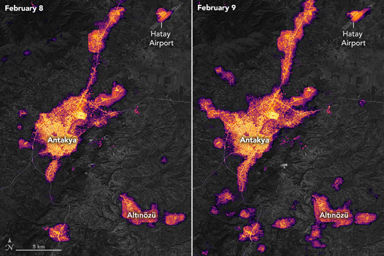
In this image, when it comes to February 9, the surrounding districts and neighborhoods electricity is coming but it seems that much of the city is still dark…